Jones Corral Draw
1946
1953
1959
Description:
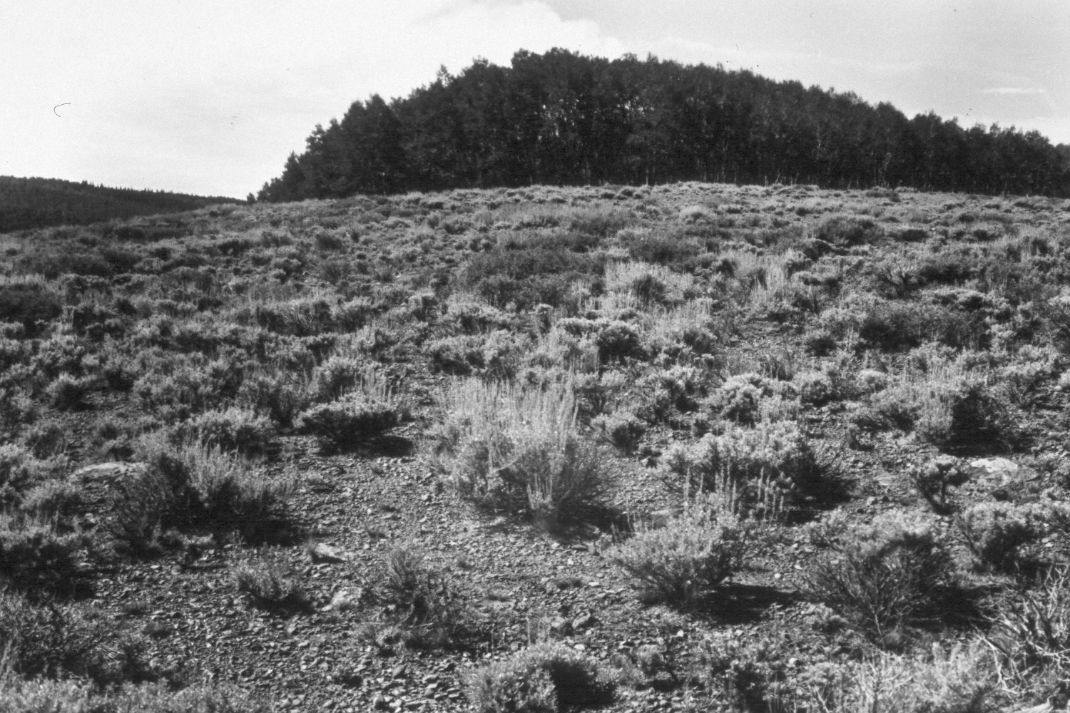
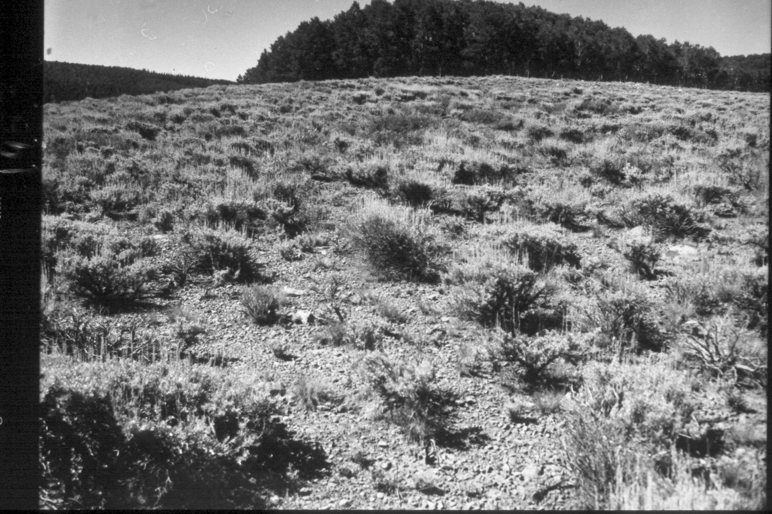
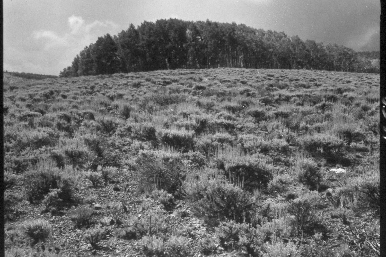
Plate 162X. Jones Corral Draw 1946 - 1953 - 1959 - 2003 The Jones Corral Draw Photo Plot Transect was established in 1943 and reread in 1946, 1953, 1959, and 1979. Initial range conditions were described as poor and soil erosion was widespread. Native grasses were described as rare and snowberry and aspen were very heavily browsed by both mule deer and cattle. The area along the drainage was reseeded in 1946 with smooth brome, crested wheatgrass, and timothy. When the transect was reread in 1979, native grasses had increased, snowberry was described as being “in good vigor”, and according to Dr. Jim Bowns, the range appeared “to be in good ecological condition with an upward trend” (unpublished reports in range files, Panguitch Ranger District, Panguitch, UT). Plate 162x is viewed southwest at the end of the Photo Plot Transect. Note the erosion pavement in the 1946 photo. Sagebrush has increased, as have various native grasses including squirreltail (Sitanion hystrix), muhlygrass (Muhlenbergia montana and M. richardsonis), and slender wheatgrass (Agropyron trachycaulum). Aspen, though, has been heavily invaded by conifers and most stands in the area have not successfully regenerated in nearly 100 years due to repeated browsing of aspen suckers by livestock and wildlife. Where herbivory has been excluded, however, aspen has successfully regenerated without fire or other disturbance (Kay and Bartos 2000; plus personal observations at newly constructed aspen exclosures on Mount Dutton).
Photo Information:
U.S. Forest Service photographs (unnumbered) by Walter Cottam on August 24, 1946; I.H. Johnson on August 6, 1953; and I.H. Johnson on September 15, 1959; retake by Charles E. Kay on July 11, 2003 - - Photo No. 5178-2. Original photographs, negatives, and narrative reports held in the range files on the Panguitch Ranger District, Dixie National Forest, Panguitch, UT.
Vegetative Community:
Mountain Brush, Aspen, Sagebrush
Location:
South West: Section 26, Range 3 West, Township 31 South; UTM for the transect starting point 398150E, 4215700N; elevation 9,600 ft.