Griffin Point
1948
1953
2003
Description:
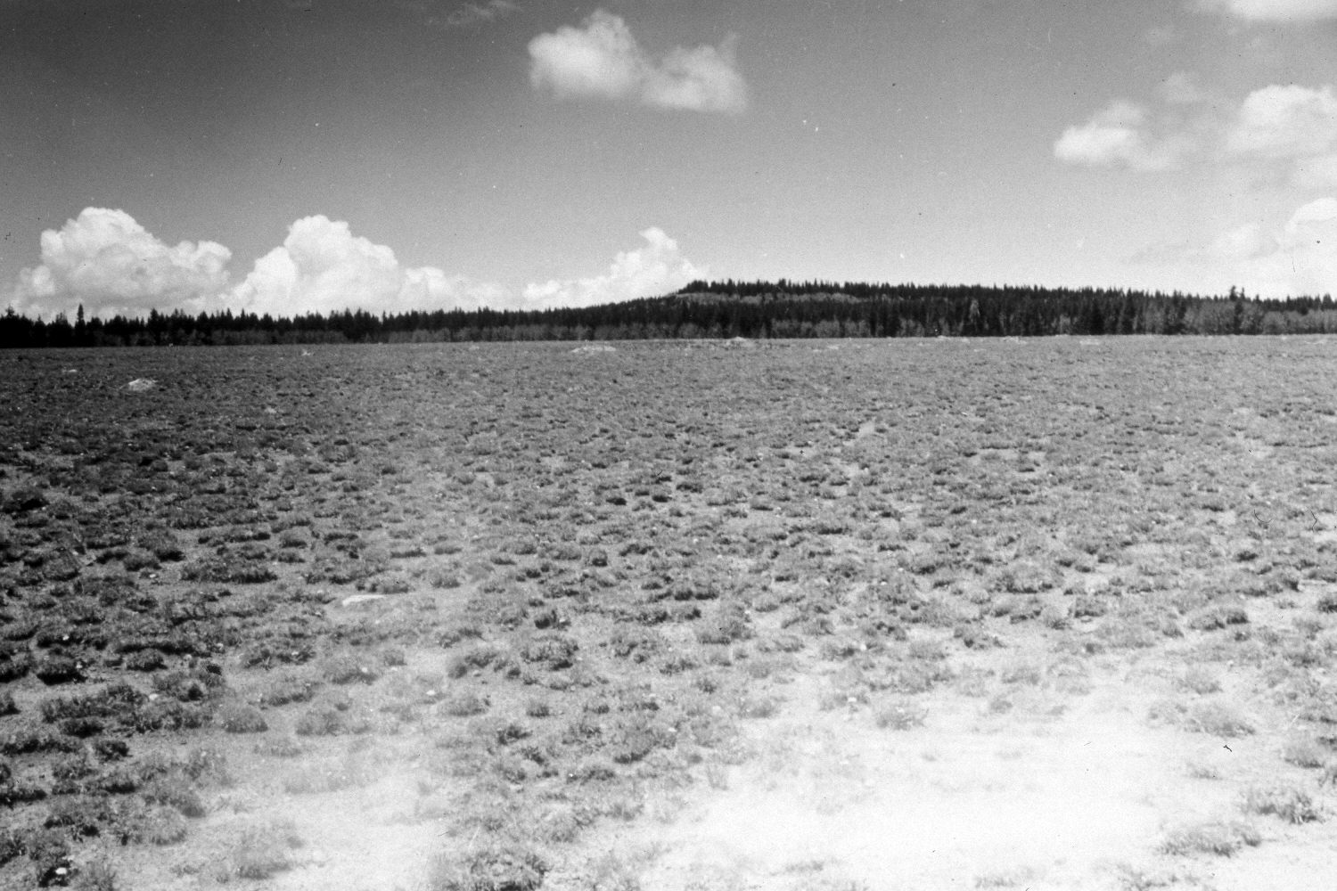
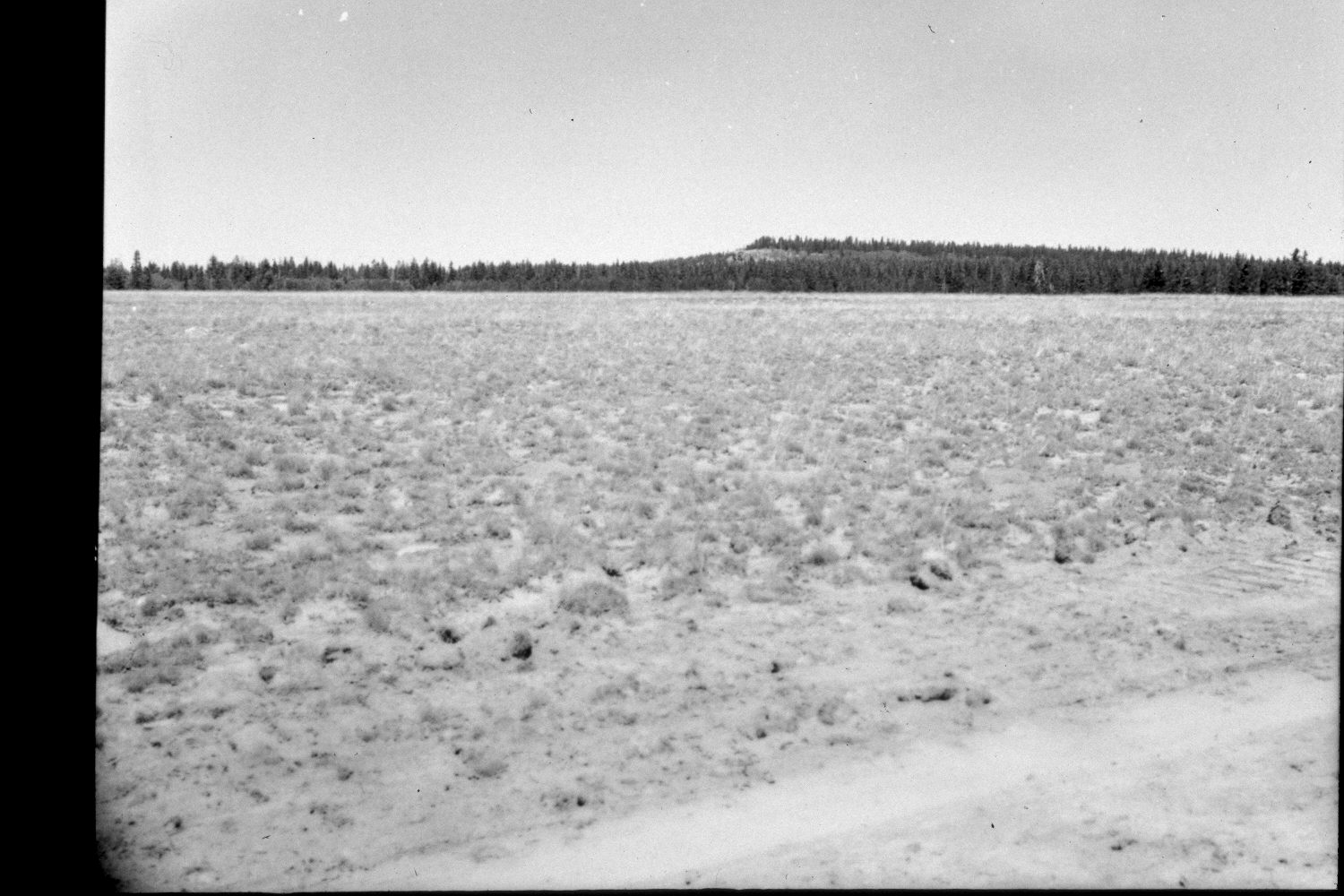
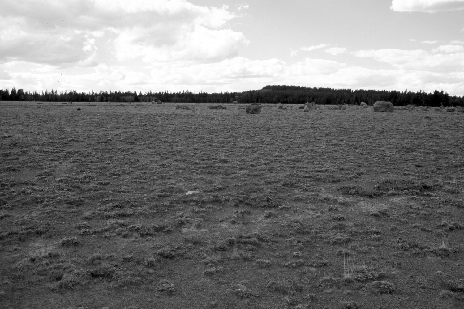
Plate 345X. Griffin Point 1948 - 1953 - 2003 The Griffin Point Photo Plot Transect was established in 1943 and reread in 1948, 1953, and 1979. The transect starting point is immediately south of the Griffin Point exclosure built in 1943. When this Photo Plot Transect was established the area was very heavily grazed by domestic sheep. “The Griffin Point transect samples the characteristic [high elevation] Festuca type where soil erosion is most pronounced and where the grass clumps of Festuca ovina [sheep fescue] stand the highest above the soil.” In 1953, I.H. Johnson noted that “the marked declines in [sheep] fescue and mutton bluegrass [Poa fendleriana] are the principal reasons for concluding that the vegetation trend continues to be downward…since active sheet erosion is continuing on each of the five transect plots and [plant] litter is almost totally unsatisfactory, soil trend is also downward.” In his 1979 report on this Photo Plot Transect, Dr. Jim Bowns, range ecologist at Southern Utah University, wrote that “the prominent feature of the landscape is the pedestaling of Festuca ovina and [pocket] gopher activity….[the pedestaling has been] interpreted by previous investigators…[as] a result of overgrazing and subsequent soil erosion. These pedestaled plants, however, are prominent even in the [adjacent] exclosure and the metal pegs marking the [transect] plot boundaries are no higher [today] than when originally placed. [Thus,] it appears that the hummocking is, rather, a cryopedogenic process resulting in frost hummocks. There is little difference between the grazed area and the exclosure. The only notable difference is the smaller and less abundant F. ovina outside. The grass identified as Poa fendleriana [in earlier reports] is actually Poa canbyi. This range appears to be in good condition and the trend up or at least stable.” (unpublished reports in the range files on the Escalante Ranger District, Dixie National Forest, Escalante, UT). Plate 345x is viewed northwest from the end of the Photo Plot Transect. Seen in the distance is Mud Springs Point (10,748 ft). The white area in the foreground of the 1948 image is where light damaged the negative. The disturbed area in the foreground of the 1953 image is a newly constructed logging road that has since naturally revegetated - - see Plate 344x. The boulders in the distance were moved onto the meadow when Forest Service Road 140 was built across the transect. Spruce has increased on the far hillside while aspen has declined. The site was actively being grazed by cattle in 2003. Ground cover appears to have increased despite the recent drought.
Photo Information:
U.S. Forest Service photographs (unnumbered) taken by Ray J. Davis on June 28, 1943; and Walter P. Cottam on June 27, 1948; retake by Charles E. Kay on August 25, 2003 - - Photo No. 5255-22A. Original photographs, negatives, and narrative reports held in the range files on the Escalante Ranger District, Dixie National Forest, Escalante, UT.
Vegetative Community:
Conifer, Aspen, Dry Meadow
Location:
South West: Section 2, Range 1 West, Township 34 South; UTM of transect starting point 423700 E, 4193300 N; elevation 10,460 ft.