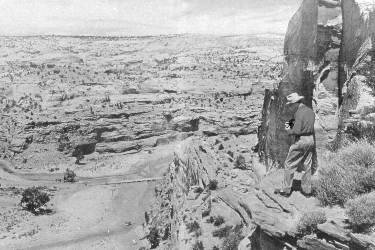
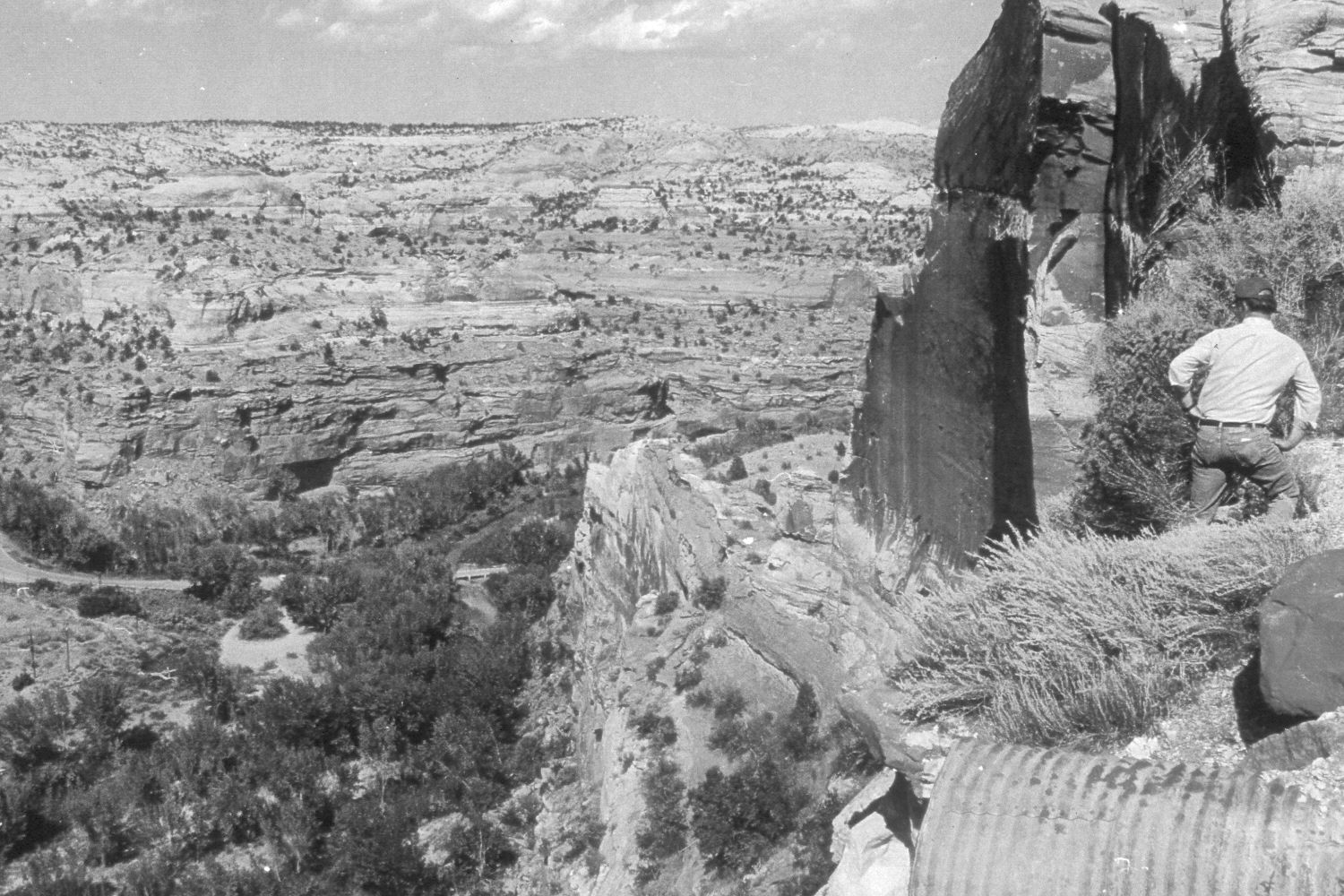
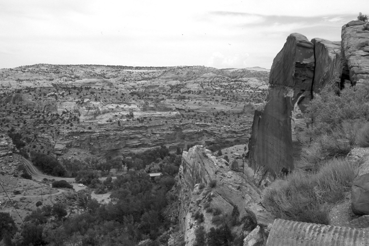
Escalante River
1949
1993
2002
Description:
Plate 53X. Escalante River 1949 – 1993 – 2002 Viewed east-northeast to the confluence of Calf Creek and the Escalante River from the overlook on Utah Highway 12. Note how little woody riparian vegetation there was in 1949 and how conditions had improved by 1993. Woody riparian vegetation also increased between 1993 and 2002. Most of the plants are willows and cottonwoods. Very little tamarisk is present. Pinyon and juniper appear to have increased ever so slightly. Note the old bridge in the 1949 and 1993 photos and the new bridge in the most recent retake - - see Plates 46X and 49X.
Photo Information:
The original photographers are unknown - - the 1949 and 1993 photos are part of BLM’s display at the overlook. Retake by Charles E. Kay on July 10, 2002 - - Photo No. 4973-10. Original photographs held by Southern Utah University Archives and Special Collections, Cedar City, UT.
Vegetative Community:
Riparian, Pinyon, Juniper
Location:
South West: Section 12, Range 4 East, Township 35 South; UTM 462900E, 4180400N; elevation 5,550 ft.