Dry Flat
1948
1953
1978
Description:
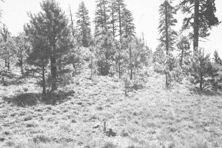
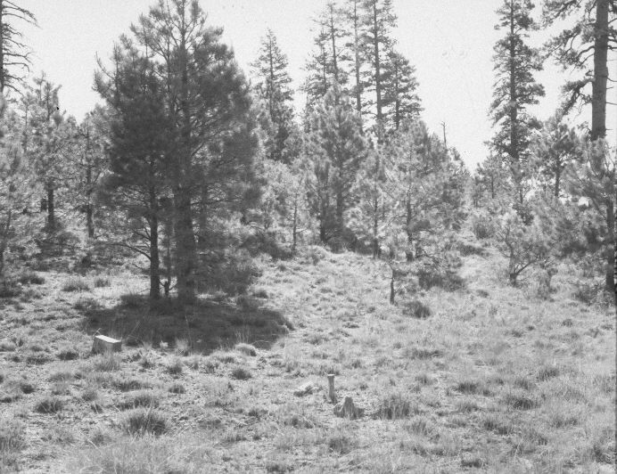
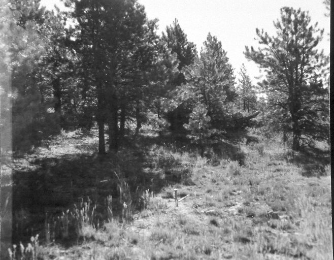
Plate 974X. Dry Flat 1948 – 1953 – 1978 – 2005 This Photo Plot Transect was established by the Forest Service in 1943 to monitor range conditions on Dry Flat approximately two miles southwest of Unita Flat. According to early narrative reports, the area was very heavily grazed by livestock when the transect was established, and soil erosion was a major concern. “Heavy adjustments in sheep use followed the 1945 period. Improved management such as hauling water and eliminating trailing was inaugurated about this time. The shallow soil on the ridges may require a lot less use to get very noticeable improvement…soil movement was evident around Stipa clumps even though the area is almost level. Soil remnants capped by small pebbles were common…Rill marks were conspicuous on several plots. Root crowns of many Stipa plants are one to two inches above the general soil level.” Despite an increase in the number and size of ponderosa pine, range conditions had improved by 1978 when Dr. Jim Bowns reported that the “allotment is now in good condition and the trend is up. Although numbers have been reduced, this is still a sheep allotment.” The Photo Plot Transect is 1,800 ft. in length and begins 25 feet south of the corner common to sections 2, 3, 10, and 11. Plate 974x is viewed north to the USGS section corner that is visible in the images. The forest behind the section corner has been logged and then thinned. Nevertheless, ponderosa pine has increased reducing forage production. Needle and thread is the most common grass, while the taller shrubs are currants. Bitterbrush and green rabbitbrush are also present.
Photo Information:
U.S. Forest Service photographs (unnumbered) taken by W.P. Cottan on August 10, 1948, by I.H. Johnson on July 13, 1953, and by Al Tait on August 17, 1978; retake by Charles E. Kay on July 31, 2005 - - Photo No. 5492-32. Original photographs, negatives, and narrative reports held in the range files on the Cedar City Ranger District, Dixie National Forest, Cedar City, UT.
Vegetative Community:
Conifer, Dry Meadow
Location:
South West: Section 10, Range 7 West, Township 38 South; UTM of the transect starting point 357550 E, 4154450 N; elevation 8,040 ft.