Deer Creek
1943
1948
1953
Description:
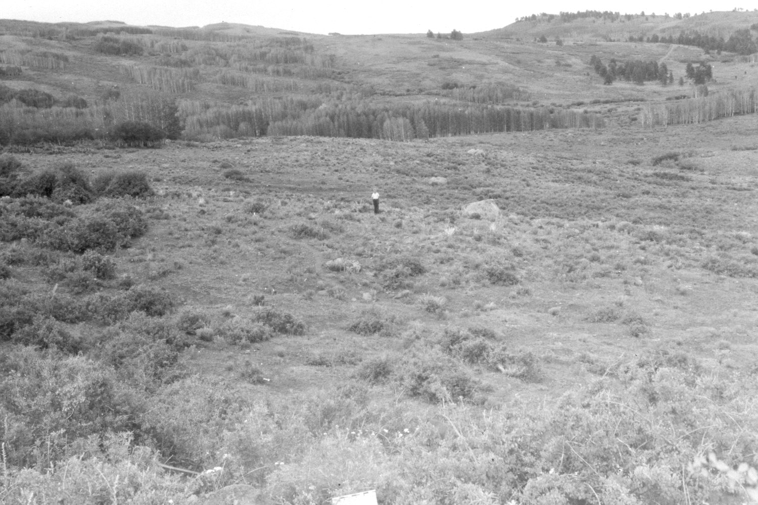
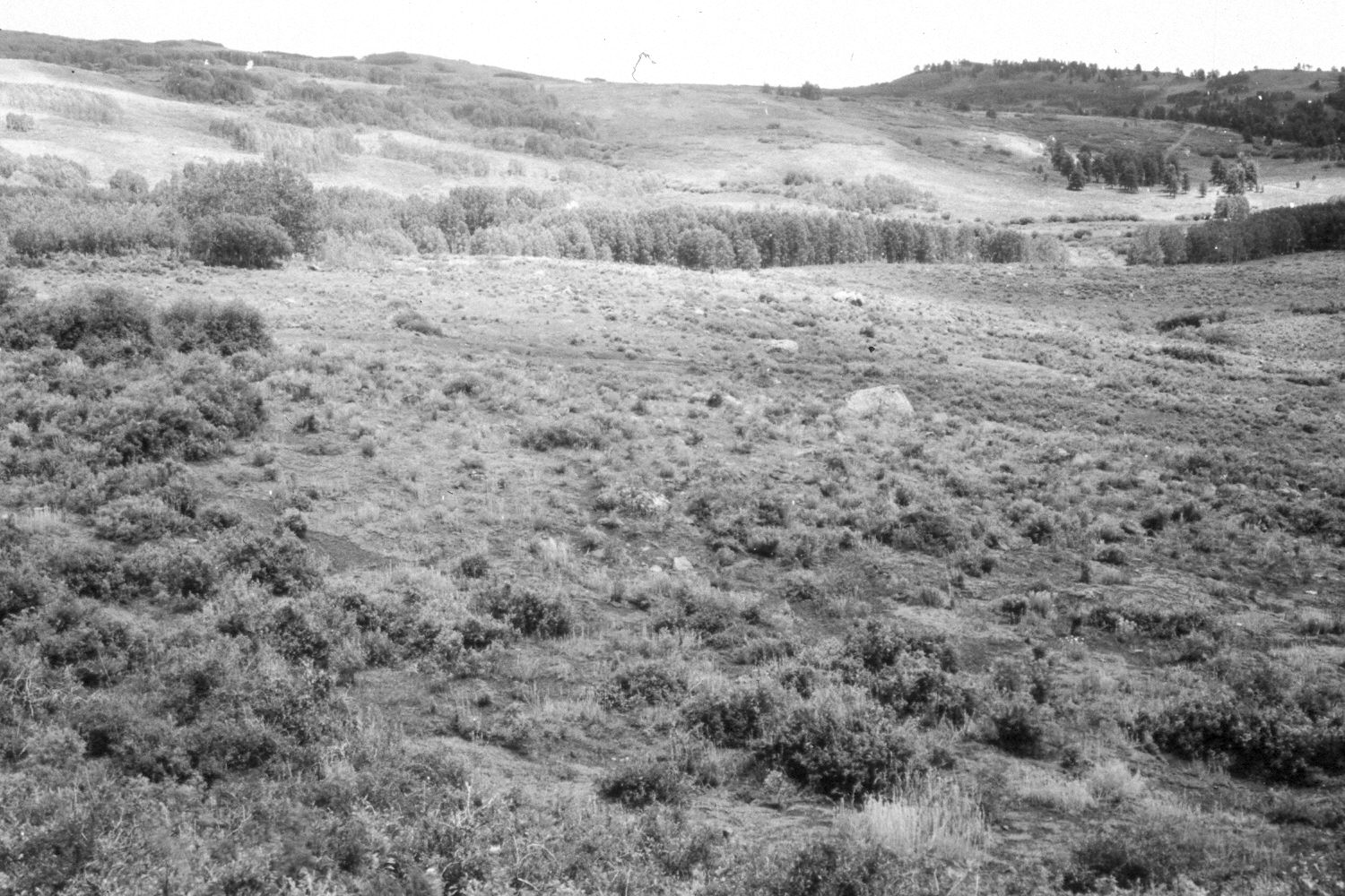
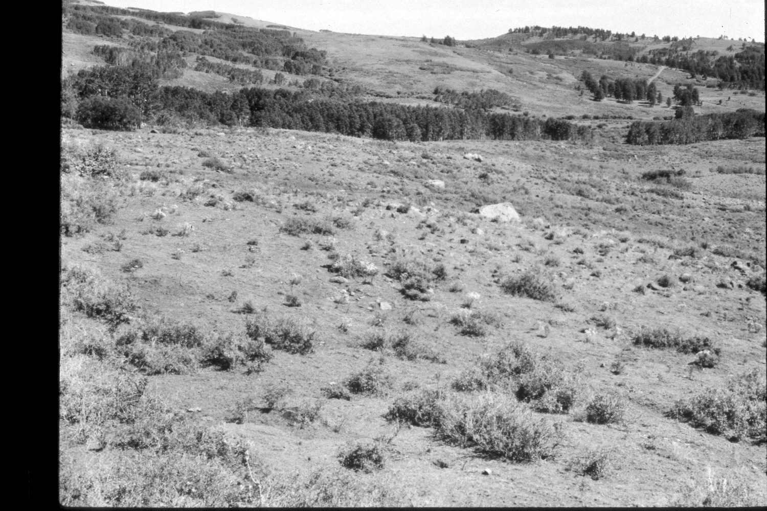
Plate 374X. Deer Creek 1943 - 1948 - 1953 - 1959 - 2003 The Deer Creek Photo Plot Transect was established in 1943 on the southern flank of Boulder Mountain and reread in 1948, 1953, 1959, 1976, and 1979. The transect consists of 13 plots and is 4900 feet in length. The transect crosses both Middle Deer Creek and West Deer Creek several hundred yards north of Utah Highway 12. The transect samples a series of meadows interspersed with aspen. When the transect was established in 1943 the area was very heavily grazed by domestic sheep and range conditions were poor. Ray Davis noted that all shrubs had been heavily browsed and that aspen was “hedged and showed little signs of reproduction.” In 1948, Dr. Walter Cottam reported that “there has been terrible soil movement in this general area. From two to four inches of soil is gone from most plots as indicated by licken marks and mounded shrubs.” I.H. Johnson, who remeasured the transect in 1953 and 1959, found that the vegetation trend was down and that soil erosion was still common. By 1979, though, Dr. Jim Bowns, range ecologist at Southern Utah University, reported that “vegetation is much more abundant here now than it was in 1943…In general the area has improved since the transect was established. The condition would be high fair [or] low good” (unpublished reports in the range files on the Escalante Ranger District, Dixie National Forest, Escalante, UT). Plate 374x is viewed southeast back to the Photo Plot Transect starting point on the distant ridge - - see Plate 371x. The person in the 1943 image is standing on the transect centerline. The tall shrubs on the left are Utah serviceberry (Amelanchier utahensis) and chokecherry (Prunus virginiana) - - the latter appears to have declined. Today, all chokecherry plants are heavily browsed by deer and elk, as it is a preferred forage species for wildlife. Oakbrush has increased, especially on the ridge in the mid-distance. Snowberry and green rabbitbrush also appear to have increased. Willows in the distance appear unchanged. Many aspen stands in the immediate area successfully regenerated about 30 years ago when mule deer populations declined, but not before or since due to excessive browsing of aspen suckers by deer, elk, and livestock (Kay and Bartos 2000). The area was actively being grazed by cattle in 2003, and deer and elk sign was common.
Photo Information:
U.S. Forest Service photographs (unnumbered) taken by Ray J. Davis on July 28, 1943; Walter P. Cottam on July 28, 1948; and I.H. Johnson on September 10, 1953; and I.H. Johnson on July 28, 1959; retake by Charles E. Kay on August 29, 2003 - - Photo No. 5272-3. Original photographs, negatives, and narrative reports held in the range files on the Escalante Ranger District, Dixie National Forest, Escalante, UT.
Vegetative Community:
Aspen, Mountain Brush, Oakbrush
Location:
South West: Section 19, Range 5 East, Township 32 South; UTM 464000 E, 4207400 N; elevation 9,040 ft.