Davis Flat
1948
1953
2003
Description:
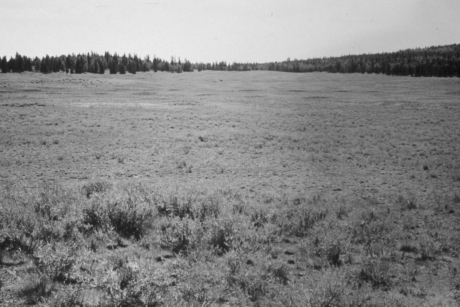
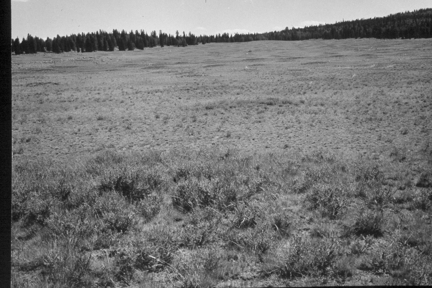
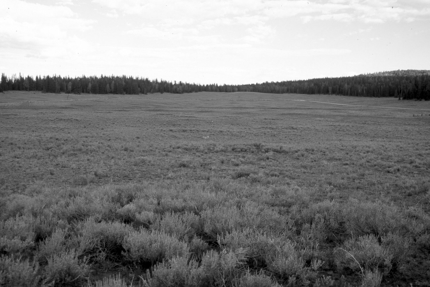
Plate 329X. Davis Flat 1948 - 1953 - 2003 The Davis Flat Photo Plot Transect on the Aquarius Plateau was established in 1943 and reread in 1948, 1953, and 1979. The transect is 1900 feet in length with plots at 200 foot intervals beginning 100 feet from the starting rock carin. Range conditions were poor when this Photo Plot Transect was established and soil erosion was widespread. In 1953, I.H. Johnson noted that “litter-soil conditions continue to deteriorate…erosion pavement was more conspicuous…and generally, there was more bare area between grass clumps….The trend is downward because grass species are either just barely holding their own or losing ground and undesirable or low value forbs…are rapidly increasing. The fact that some of these forbs are invading long established grass clumps is further evidence of…unsatisfactory conditions…”. When the Photo Plot Transect was remeasured in 1979, Dr. Jim Bowns, range ecologist of Southern Utah University, found that range conditions were “fair” with an upward trend and that soil erosion was “slight to moderate” (unpublished reports in the range files on the Escalante Ranger District, Dixie National Forest, Escalante, UT). Plate 329x is viewed southeast back down the Photo Plot Transect to its starting point - - see Plate 328x. The entire area is dotted with mima mounds - - slightly-elevated circular landforms created by pocket gophers over hundreds or thousands of years. Silver sage appears to have increased and is especially thick on the top of mima mounds where soils are deeper. Despite the severe drought that has gripped southern Utah for several years, range conditions appear to have improved. On the far hillsides, conifers have increased, while aspen has declined. Note the wooden-fenced exclosure on the upper right edge of the 2003 image.
Photo Information:
U.S. Forest Service photographs (unnumbered) taken by Walter P. Cottam on August 1, 1948; and I.H. Johnson on August 24, 1953; retake by Charles E. Kay on August 25, 2003 - - Photo No. 5255-31A. Original photographs, negatives, and narrative reports held in the range files on the Escalante Ranger District, Dixie National Forest, Escalante, UT.
Vegetative Community:
Sagebrush, Conifer, Aspen
Location:
South West: Section 11, Range 2 West, Township 32 South; UTM of transect starting point 437850 E, 4206350 N; elevation 9,640 ft.