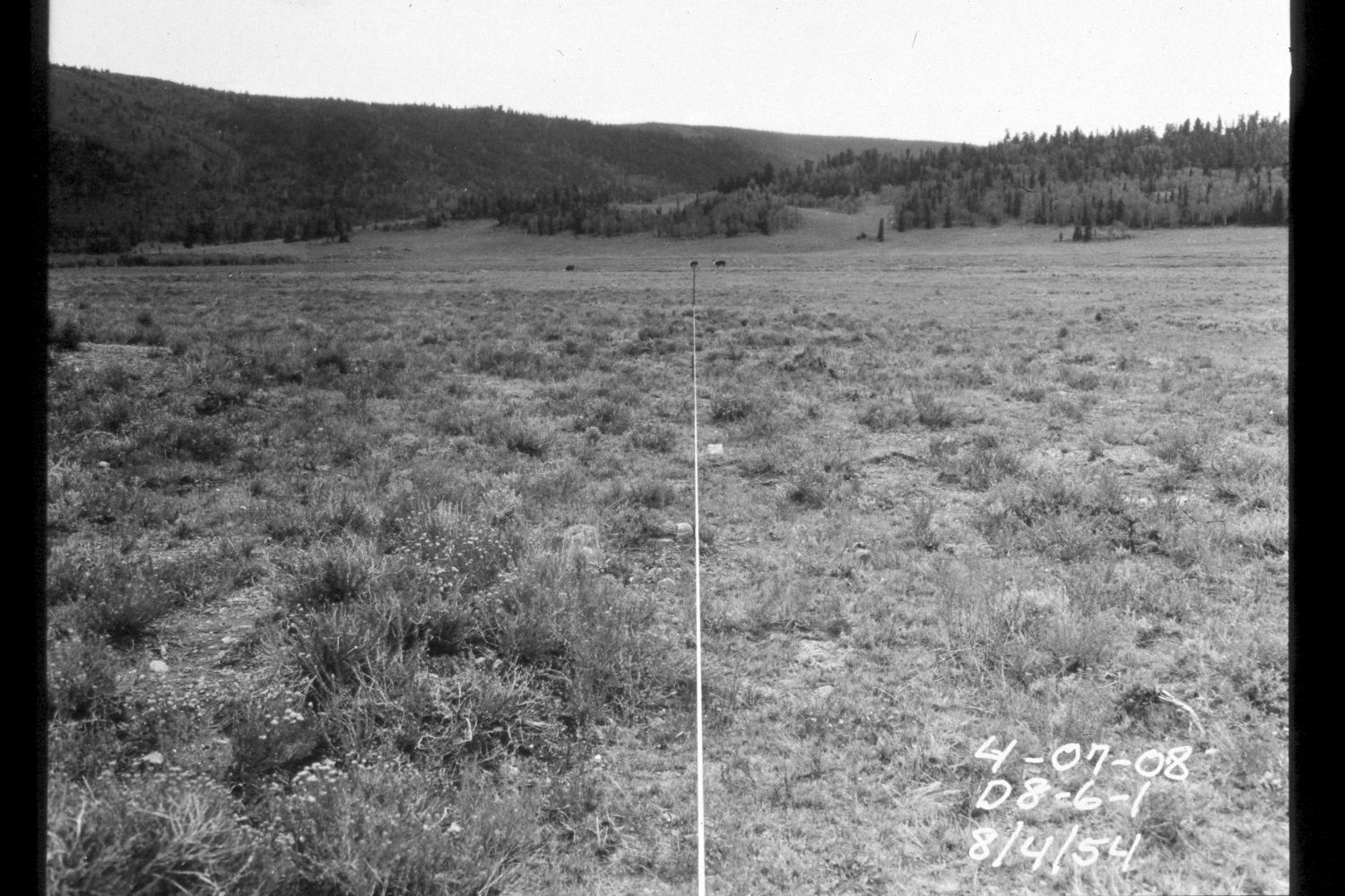
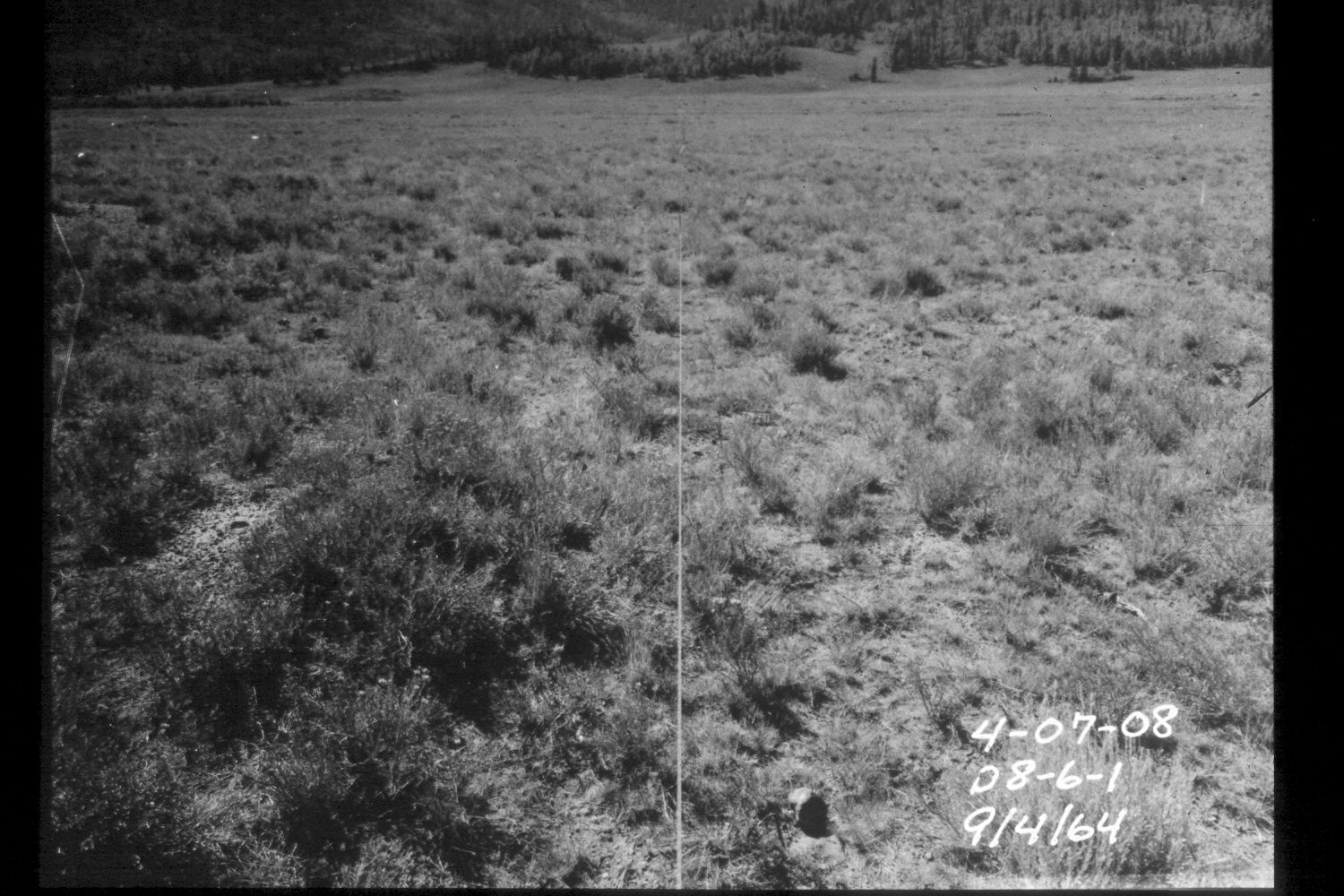
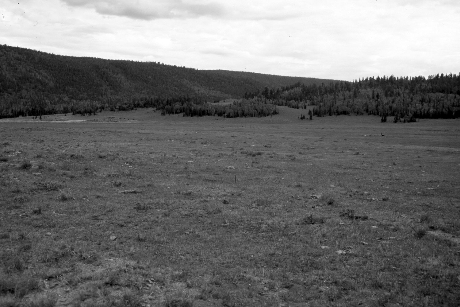
Dark Valley
1954
1964
2003
Description:
Plate 353X. Dark Valley 1954 - 1964 - 2003 Viewed southeast up Dark Valley just to the west of Boulder Top. This is part of an old Parker 3-step range transect - - note the steel stakes in the 2003 retake. The fenced area in the distance is a private inholding. There, willows have declined, as the private landowner expanded his irrigated haylands. The surrounding Forest Service lands were heavily grazed by cattle and elk in 2003 - - this area is apparently a major elk winter range. Silver sage, threetip sage, and green rabbitbrush were all heavily browsed. Conifers in the distance have increased, while aspen has declined. All aspen suckers had been repeatedly browsed by cattle and wildlife, and elk have started to eat the lower bark on aspen trees. Sagebrush and other shrubs have declined. Note the mima mounds on the left edge of the photos. In 1986, the Utah Division of Wildlife Resources (DWR) and the Forest Service built a fairly sizable dam several hundred yards behind, and downstream of, the camera station - - that area was then fenced to exclude livestock. Since the valley is so flat at this point, the dam raised the watertable over a large area, including the meadow in the foreground. This likely explains why sagebrush and other shrubs have declined, as those species do not tolerate high watertables. The foreground is now largely a subirrigated meadow instead of the sagebrush flat it was in 1954 and 1964.
Photo Information:
U.S. Forest Service photographs (unnumbered) taken on August 4, 1954 and September 4, 1964; retake by Charles E. Kay on August 26, 2003 - - Photo No. 5259-24. Original photographs held in the range files on the Teasdale Ranger District, Dixie National Forest, Teasdale, UT.
Vegetative Community:
Sagebrush, Conifer, Aspen
Location:
South West: Section 5, Range 3 East, Township 31 South; UTM 447500 E, 4221200 N; elevation 8,950 ft.