Bee Lake
1872
2002

Plate 92X
Description:
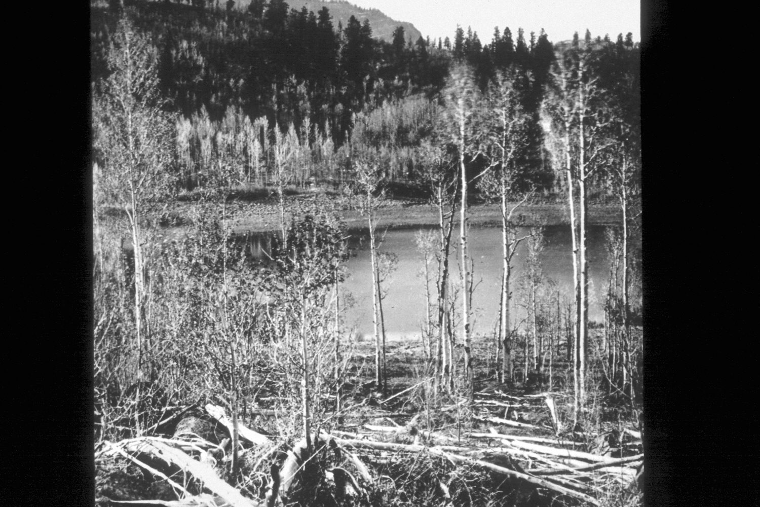
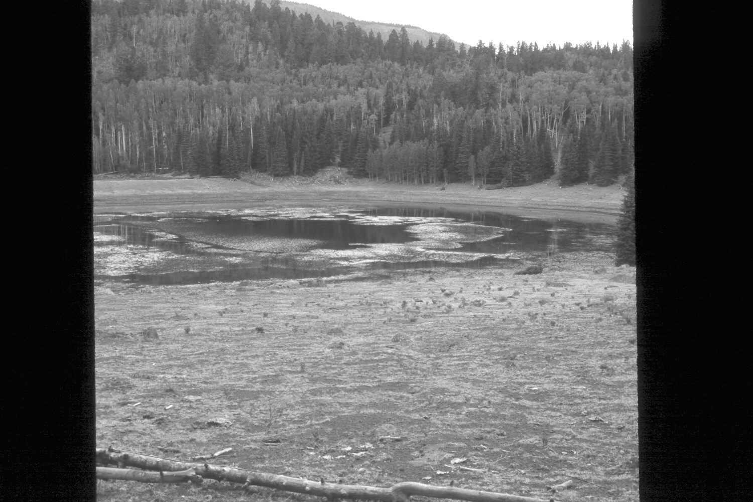
Plate 92X. Bee Lake 1872-2002 This repeat photoset is similar to Plate 99x. Hillers referred to this body of water on the southern flank of Boulder Mountain as Bee Lake, though today it is not named on either U.S. Forest Service of U.S. Geological Survey maps. On USGS’s 1:24,000 Jacobs Reservoir map, this lake is simply marked with its elevation of 9,547 feet and is located approximately 400 yards east of Bear Lake. The 1872 image shows a multi-aged, regenerating aspen community between the camera and the lake. That picture, however, was taken in early spring before the aspen were fully leafed-out or the understory had regrown. The vegetation in the original, though, had never been grazed by livestock, as this area was not settled until after the photograph was taken. The original aspen also showed no sign of browsing by either deer or elk, unlike conditions today, and suggest that present wildlife numbers are not reflective of historical conditions. The tall willows seen behind the lake in 1872 have been repeatedly browsed by livestock and the few remaining plants are all less than a foot tall. There is no dam on this lake nor is there any natural or man-made outlet. The original photopoint could not be precisely relocated because, in the absence of the frequent, low-intensity fires that once swept this area, a dense forest has now become established. Aspen trees have matured only to be invaded by conifers, primarily spruce and subalpine fir. Across the lake, the large, old conifers were all Douglas fir that survived repeated, non-crown fires, as judged by the interspersed regenerating aspen. Most of those trees grew on rocky outcrops, or other fire refugia, where the sparse ground cover once limited the spread of fire. Nevertheless, many of those trees are fire scarred. Today, however, that hillside is covered with dense growths of regenerating conifers, primarily spruce and fir, and would now support high-intensity, stand-replacing crown fires, something that never happened in the past. The lake level was lower in 2002 due to the extended drought that has gripped southern Utah for several years. The photo is viewed northeast to Boulder Top (10,800 ft.).
Photo Information:
John Hillers photo 488 taken on June 10, 1872 (Fowler 1972:118); retakes by Charles E. Kay on September 17, 1996 - - Photo Nos. 4988-18 and 4998-12. Original photo (RG-057-PS) held by the National Archives, Washington D.C.
Vegetative Community:
Conifer, Aspen, Riparian
Location:
South West: Section 18, Range 4 East, Township 32 South, UTM 455800 E, 4208700 N; elevation 9,580 ft.