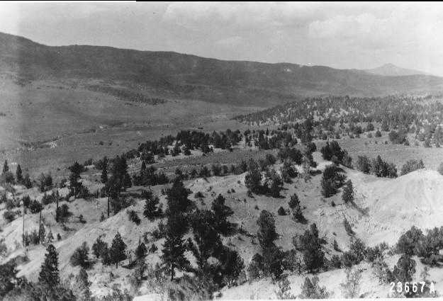
Taylor Flat
1915
1996
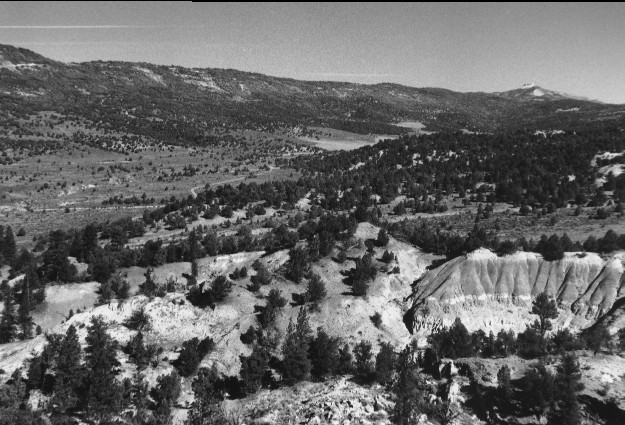
Description:
Plate 37. TAYLOR FLAT: 1915 - 1996 Viewed over Taylor Flat to Water Hollow Ridge and Musina Peak. The 1996 photo point was moved uphill and to the east because pines now block the 1915 photo point. The conifers in the badlands show little change and are primarily ponderosa pine (Pinus ponderosa), Douglas-fir (Pseudotsuga menziesii), pinyon pine (Pinus edulis), and juniper (Juniperus sp.). Behind the badlands and on Taylor Flat, however, the pinyon and juniper have increased markedly. The various creeks and drainages were downcut in 1915, but they appear even deeper in 1996 indicating that the downcutting has continued. New fields are visible on the private land in the valley bottom. The vegetation on Water Hollow Ridge is mostly oak brush (Quercus gambelii?), pinyon, and juniper which appear to have increased. The vegetation in the open areas is primarily sagebrush (Artemisia tridentata) which has decreased as the pinyon-juniper has expanded in the absence of fire.
Photo Information:
1915 photo taken by U.S. Forest Service #233667A; 1996 photo is Kay #4069-26, taken on Sept, 26. Forest Service photo held by the National Archives #RG-95-G, Washington D.C.
Vegetative Community:
Conifer, Juniper, Pinyon, Oakbrush
Location:
South Central: Hilgard Mountain, Fishlake N.F, Richfield R.D., T22S, R3E., Sect. 22, UTM 4304450 N, 451300 E; elevation 7,000 ft.; view to north.