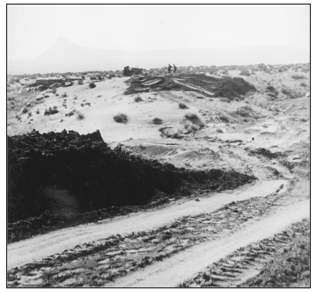
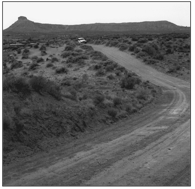
Tank Mesa
ca. 1937
1999
Description:
TANK MESA The original photograph is of a CCC road development project some three miles southwest of Decker Ranch. The view is to the southwest across BLM administered land. The original image is poor quality, the background mesa is faintly visible in the 1937 photograph. This site is primarily a wind blown very sandy loam inclusion over a Moenkopie-rock outcrop complex. Sand depths here vary from a few inches to several feet. These soils are well drained with a moderately low water supplying capacity. Average annual precipitation at this site ranges from 6 to 8 inches. Seventy years of precipitation records take at Bluff, Utah some 8 miles south of this site, indicate a 7.8 inch average annual precipitation rate there. The road cut made by the Blanding CCC camp has not appreciably changed in the 62 years between photographs. The mid-ground sand dune is much more stable with a significant increase in vegetation frequency, density and ground cover. Soil binding capabilities are much improved. Vegetation on the dune and immediate area includes, sand sagebrush, purplesage, rough mulesear, fourwing saltbush, shadscale, blackbrush, Indian ricegrass, curlygrass, cheatgrass, and snakeweed. A few non-vegetated interspaces are visible at the dune crown in the left center of the 1999 photograph.
Photo Information:
Photograph Number: CCC DG-34.3 Original: Date: Ca. 1937 (- A) Photographer: Unknown Source: National Archives, Denver, Colorado Retake: Date: June 2, 1999 (- B) Photographer: Earl Hindley Source: San Juan County
Vegetative Community:
Salt Desert Shrub
Location:
San Juan: SE1/4SE1/4 Section 23 T.39S., R.21E.