Swains Creek
1951
2005
Description:
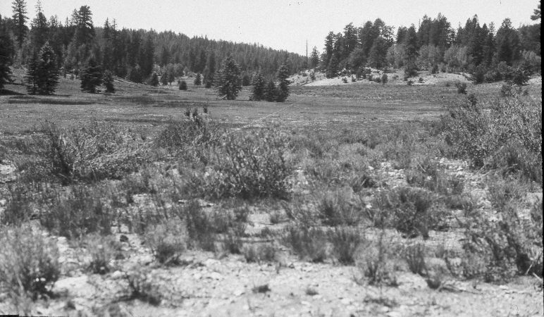
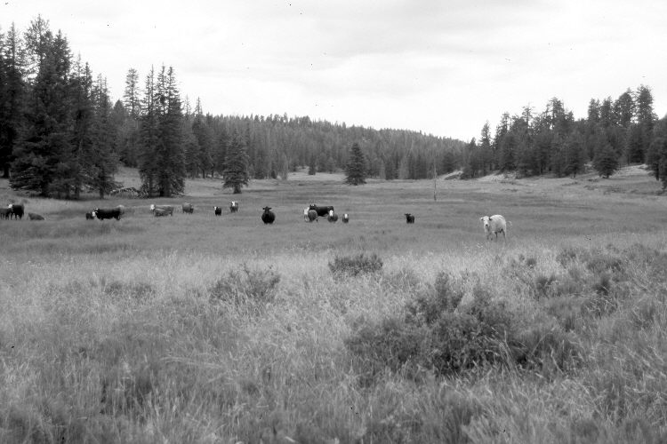
Plate 958X. Swains Creek 1951 – 2005 Viewed southwest up Swains Creek between Adair and Tar Kiln Hollows. The USFS road is on the right and a low dam has been built across the stream in the distance (photo center). The area was actively being grazed by cattle in 2005. Spruce, white fir, and ponderosa pine have increased. The shrubs in the foreground are mostly currant and green rabbitbrush, while needle and thread is the most common upland grass. The meadow is dominated by smooth brome, Kentucky bluegrass, sedges, and rushes, and appears more vegetated today than in the past. The four spruce in the center of the 1951 image have died because the dam’s overflow channel has redirected the stream flow; i.e., the watertable rose killing the spruce.
Photo Information:
U.S. Forest Service photograph (unnumbered) taken on August 24, 1951; retake by Charles E. Kay on July 29, 2005 - - Photo No. 5488-29. Original photographs, negatives, and narrative reports held in the range files on the Cedar City Ranger District, Dixie National Forest, Cedar City, UT.
Vegetative Community:
Conifer, Dry Meadow, Riparian
Location:
South West: Section 8, Range 7 West, Township 39 South; UTM 353400 E, 4144350 N; elevation 7,870 ft.