Steep Creek
1964
2002
Description:
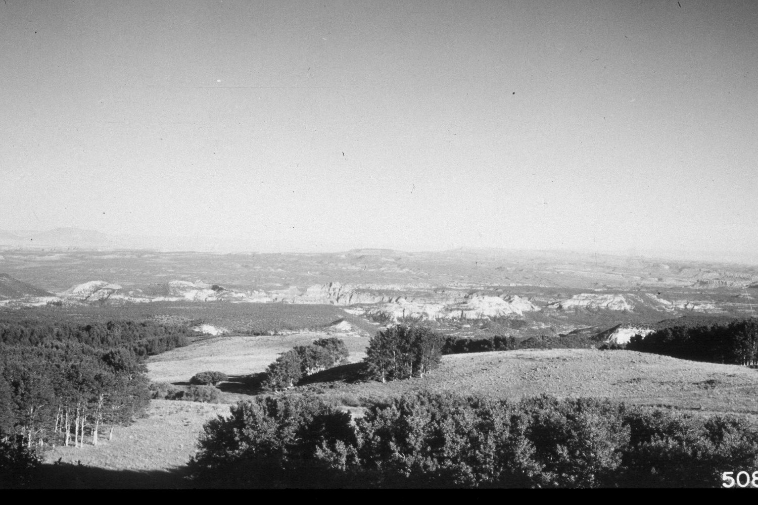
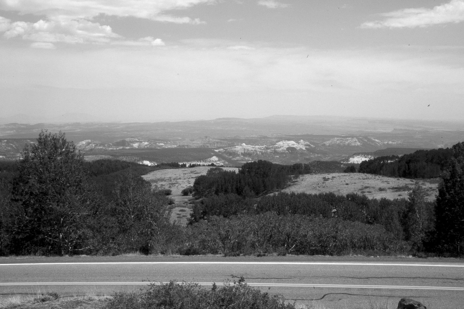
Plate 26X. Steep Creek 1964-2002 Plates 25x and 26x form a panorama down the Steep Creek drainage. Plate 25x is viewed southeast. The original photopoint was on the shoulder of Utah Highway 12, but oakbrush and aspen have increased in height and now block that view, so the retake was made from the nearest open area, which is above the road. Thus, the perspective is slightly different in the two photographs. This is part of the climax aspen zone (Mueggler 1988) on the southeast flank of Boulder Mountain and most aspen stands regenerated 25 years ago when mule deer numbers were low (Kay and Bartos 2002). Willows in the distance appear unchanged. The open area at lower elevation in the retake (photo-left center) is where fire burned a pinyon-juniper covered bench. This was a prescribed fire that escaped prescription sometime during the early 1980’s.
Photo Information:
U.S. Forest Service photograph 508881 taken by Prater in August 1964; retake by Charles E. Kay on July 8, 2002 - - Photo No. 4962-20. Original photo held by Southern Utah University Archives and Special Collections, Cedar City, UT.
Vegetative Community:
Aspen, Riparian, Pinyon, Juniper
Location:
South West: Section 16, Range 5 East, Township 32 South; UTM 468750E, 4207600N; elevation 9,400 ft.