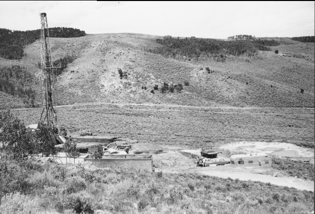
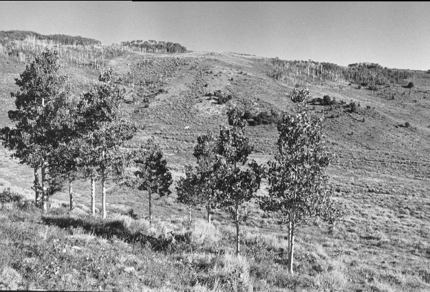
South Last Chance
1962
1999
Description:
Plate 100. SOUTH LAST CHANCE: 1962 - 1999 The 1962 photo shows an oil well drill site in the South Last Chance drainage. The foreground aspen (Populus tremuloides) in the 1962 photo were regenerating; these aspen increased in height, but no new regeneration is apparent in the 1999 photo. Aspen on the far hillside was burned sometime prior to 1999, but no aspen regeneration is apparent here either. The old Forest Service road and well pad revegetated naturally after the well was abandoned. Pinyon (Pinus edulis) and juniper (Juniperus sp.) increased on the far hillside in the time interval between the photos.
Photo Information:
1962 photo taken by the U.S. Forest Service; 1999 photo is Kay #4474-5, taken on Aug. 12. Forest Service photo held by the Loa Ranger District, Fishlake National Forest, Loa, UT.
Vegetative Community:
Aspen, Pinyon, Juniper, Sagebrush
Location:
South Central: Fishlake National Forest, Loa Ranger District, T25S, R4E, Sect. 9, UTM 4277840 N, 457620 E; elevation 9,130 ft., viewed to north.