South Fork Of Prospect Creek
1959
2003
Description:
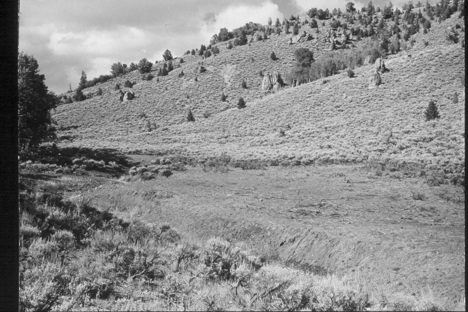
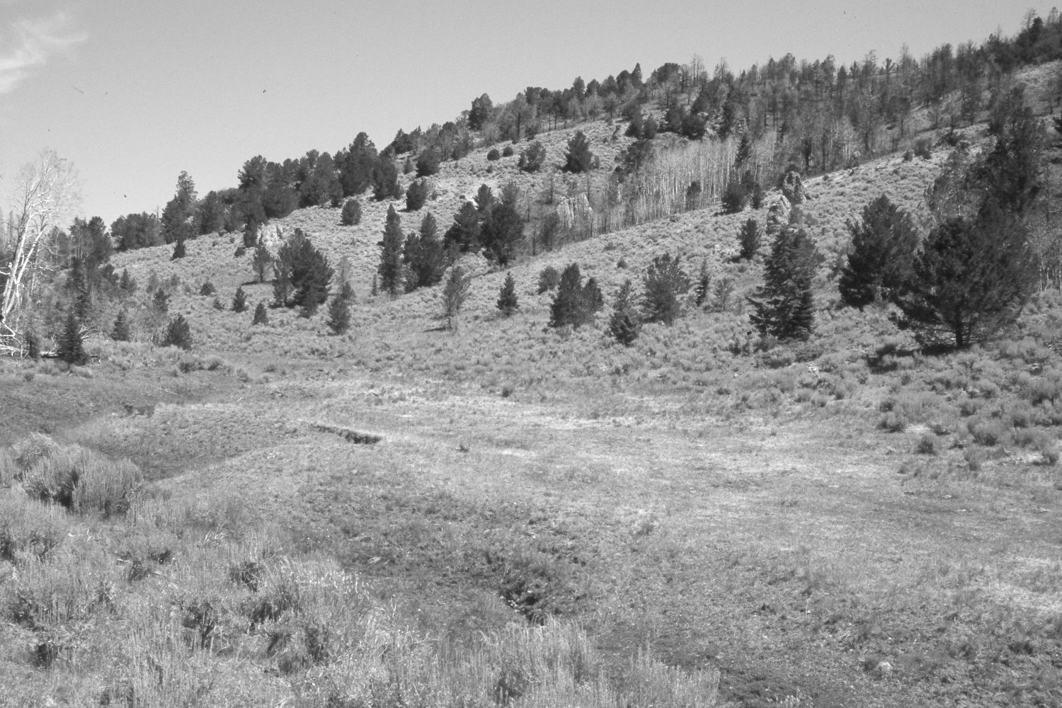
Plate 172X. South Fork of Prospect Creek 1959 - 2003 The Photo Plot Transect on the South Fork of Prospect Creek was established in 1943 and reread in 1946, 1953, and 1959. Initial range conditions were described as poor and all plant communities were very heavily grazed. According to early narrative reports, the creek channel was “gutted by erosion” and dead willows were common. “Sheet erosion [was] severe over most of the sagebrush type and even into the fringes of the aspen.” The small meadow at the transect crossing was described as “very depleted” and native grass cover was minimal. In 1953, mule deer were described as “numerous” and gullies showed “considerable recutting due to recent summer storms….Alluvial deposits [were] conspicuous where gullies terminate on flat [areas] at the base of the slopes or empty into the main drainage channel…The condition of this range is very poor or poor”. By 1959, there had been “a slight upward trend” but soil erosion was still widespread (unpublished reports in range files, Panguitch Ranger District, Panguitch, UT). Plate 172x is viewed north up the South Fork of Prospect Creek and across the transect centerline from a point 75 ft. south of plot D-241. Note the remains of dead willows in the earlier photo and how heavily grazed the meadow was in 1959. Conditions have since improved, as the meadow and associated stream banks are more heavily vegetated today than they were in earlier times. Conifers, primarily limber pine, Douglas fir, and ground juniper, have increased. Parts of the distant hillside were burned by the Sanford fire in 2002, as was the aspen stand on the left edge of this photo pair. Except for outwash from severely burned hillsides, there was no evidence of accelerated soil erosion in 2003. These aspen stands regenerated during the 1970s when mule deer population were low, but not before or since (Kay and Bartos 2000).
Photo Information:
U.S. Forest Service photographs (unnumbered) taken by I.H. Johnson on August 20, 1959; retake by Charles E. Kay on July 12, 2003 - - Photo No. 5182-20. On both the USGS 1:24,000 Adams Head (1971) topographic map and the 1995 Dixie National Forest map, this area has not been surveyed, thus there is no Section, Range, or Township; UTM of transect starting point 396600E, 4196400N; elevation 9,140 ft. Original photographs, negatives, and narrative reports held in the range files on the Panguitch Ranger District, Dixie National Forest, Panguitch, UT.
Vegetative Community:
Riparian, Sagebrush, Aspen, Conifer
Location:
South West