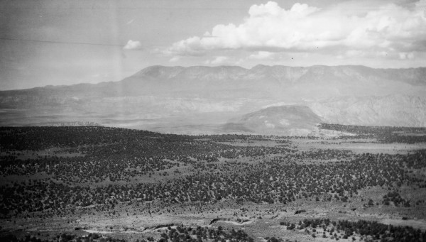
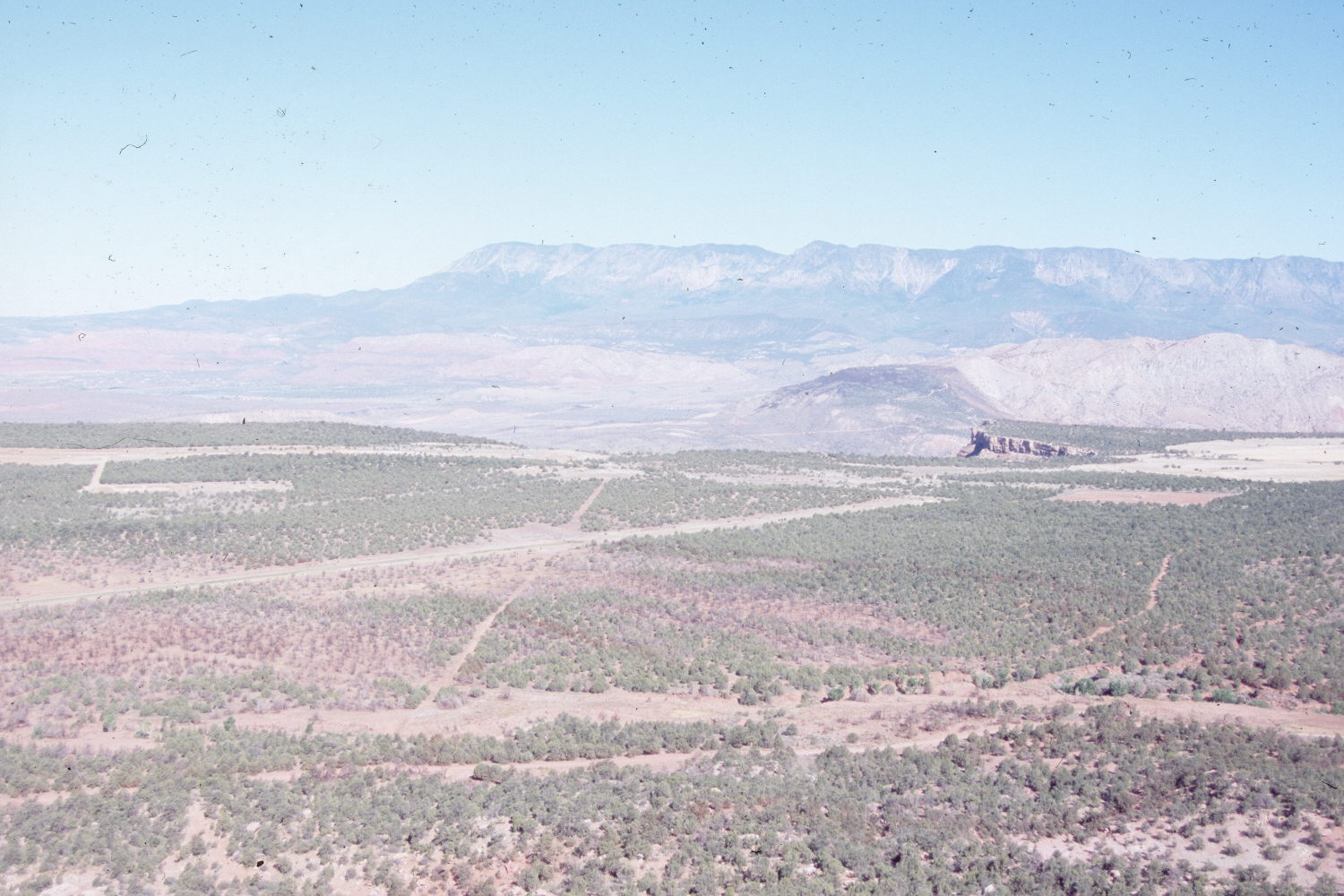
Smith Mesa
1920
2007
Description:
Plate 1445X. Smith Mesa 1920 – 2007 Viewed west from Smith Mesa to the top of Hurricane Mesa with the Pine Valley Mountains in the distance. Pinyon and juniper have increased except where cleared for roads, test tracks, and agriculture fields. Some pinyon and juniper were also killed by wildfire in 2006. The arroyo in the lower portion of the 1920 image is more vegetated today than in the past - - an indication that erosion has decreased. Cottonwoods have now established in parts of the gully.
Photo Information:
Original photograph taken by J.B. Reeside, Jr. (No. 86) ca. 1920; retake by Charles E. Kay on June 22, 2007 - - Photo No. 5813-30. Original photograph held by the U.S. Geological Survey Photographic Library, Denver, CO.
Vegetative Community:
Pinyon, Juniper
Location:
South West: Section 3, Range 12 West, Township 41 South; UTM 305419 E, 4124642 N; elevation 5,759 ft.