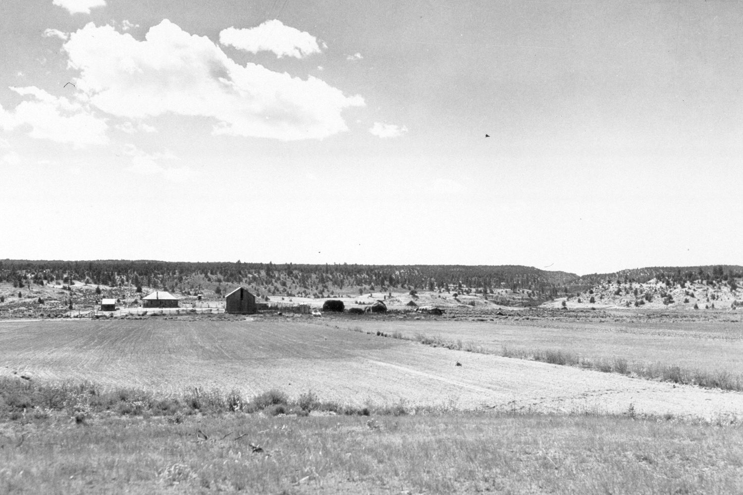
Skutumpah Canyon
1940
2004
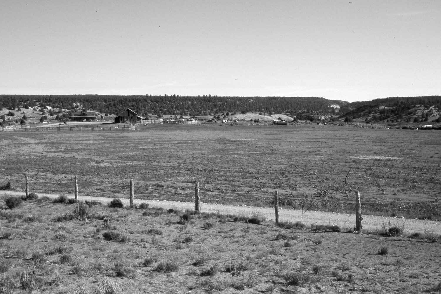
Description:
Plate 477X. Skutumpah Creek 1940 – 2004 Viewed south down Skutumpah Creek to the upper end of Skutumpah Canyon. The area in the foreground is private and has been cultivated at various points in the past. Additions have been made to the barn and ranch house. This site was originally homesteaded by John D. Lee during the 1870’s. Pinyon and juniper have increased on the distant hills, as has ponderosa pine. Wyoming big sage and green rabbitbrush are the most common shrubs in the foreground, while crested and western wheat are the most common grasses. There is very little cheatgrass.
Photo Information:
Original photograph taken by H.E. Gregory (No. 997) in 1940; retake by Charles E. Kay on June 6, 2004 - - Photo No. 5332-8. Original photograph held in the U.S. Geological Survey Photograph Library, Denver, CO.
Vegetative Community:
Pinyon, Juniper, Conifer, Sagebrush
Location:
South West: Section 5, Range 4 ½ West, Township 41 South; UTM 381350 E, 4126650 N; elevation 6,010 ft.