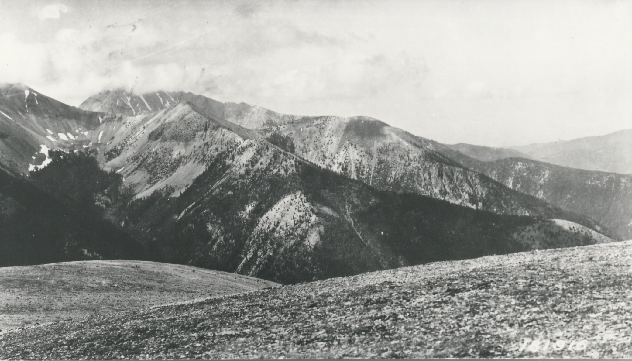
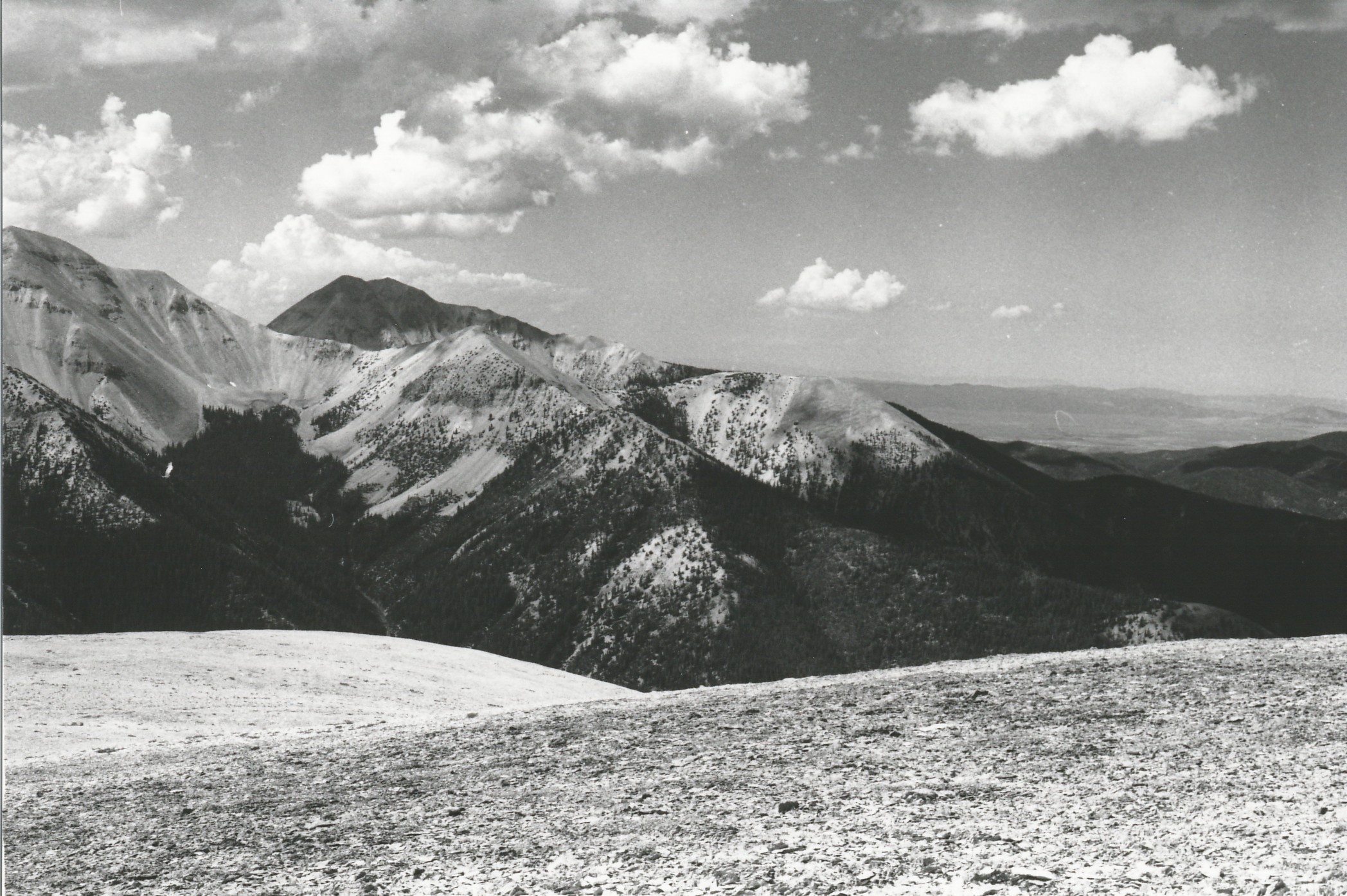
Signal Peak
1920
2001
Description:
Plate 322. SIGNAL PEAK TUSHER MOUNTAINS 1920-2001 Plates 321 and 322 form a panorama from Signal Peak in the Tusher Mountains. Plate 322 is viewed west-southwest across the head of Fish Creek to Mount Belknap (left edge - - 12,137 ft) and Mount Baldy (12,122 ft). Conifers have increased in height and numbers, but upper treeline appears unchanged. The foreground is naturally unvegetated talus.
Photo Information:
U.S. Forest Service photo 181916 ca. 1920; retake by Charles E. Kay on August 12, 2001 - - Photo No. 4874-4; Original photo (2220-Fishlake-15) held by Forest Service Regional Office Photographic Collection housed at Weber State University, Ogden, UT.
Vegetative Community:
Conifer
Location:
South Central: Section 14, Range 5 W, Township 27 S; UTM 377850 E, 4257750 N; elevation 11,300 ft.