Sidney Valley
1941
2005
Description:
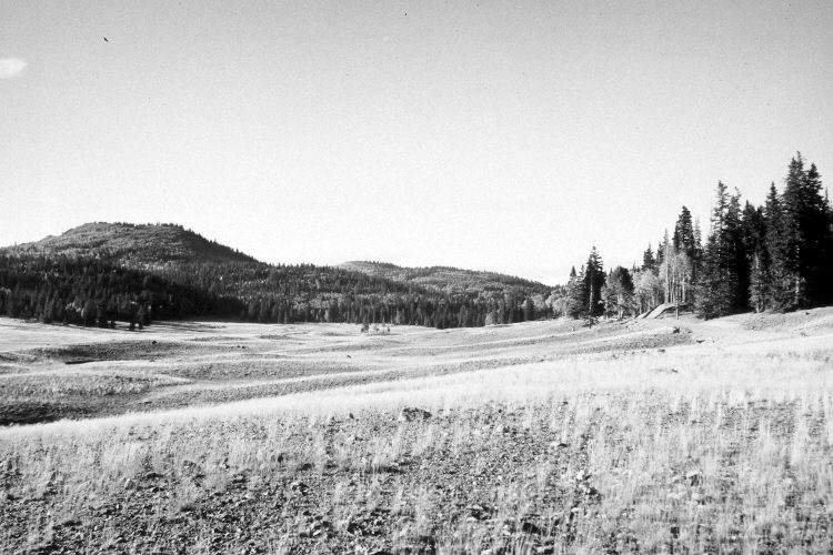
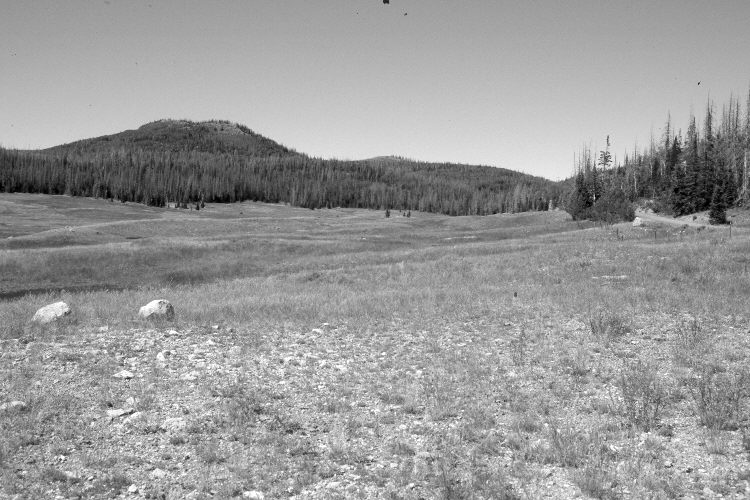
Plate 1143X. Sidney Valley 1941 – 2005 Viewed north-northwest across Sidney Valley. Sidney Peak (11,044 ft.) is in the distance. Plates 1143x and 1144x form a panorama. The foreground in the retake has been disturbed by construction - - a gravel pit lies immediately behind the photopoint. Otherwise, plant cover appears to have increased on the meadow, despite yearly grazing by cattle - - see Plates 1138x, 1139x, and 1140X. In the distance, conifers have increased, while aspen has declined. Many mature spruce, though, were recently killed by insects and disease. Aspen has not regenerated due to repeated ungulate herbivory (Kay and Bartos 2000). The area was actively being grazed by cattle in 2005.
Photo Information:
Original photograph taken by H.E. Gregory (No. 1100) in 1941; retake by Charles E. Kay on September 5, 2005 - - Photo No. 5565-4. Original photograph held by the U.S. Geological Survey Photographic Library, Denver, CO.
Vegetative Community:
Dry Meadow, Conifer, Aspen
Location:
South West: Section 17, Range 8 West, Township 36 South; UTM 334300 E, 4172000 N; elevation 10,010 ft.