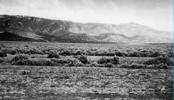
Shrits Creek Valley
1909
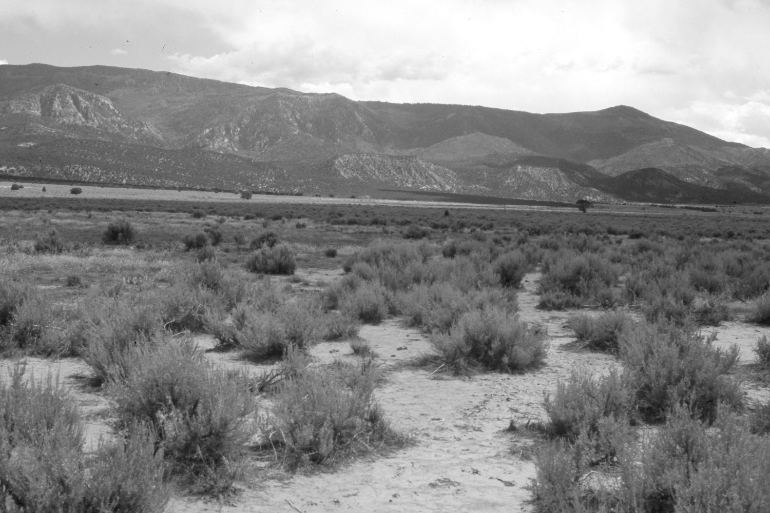
2006
Description:
Plate 1416X. Shirts Creek Valley 1909 – 2006 Viewed south-southeast up Shirts (a.k.a. Shurtz) Creek Valley south of Cedar City, Utah. Cedar Mountain and Kanarra Mountain are in the distance. The foreground has been root-plowed and reseeded with crested wheatgrass only to be reinvaded by sagebrush. Pinyon, juniper, oakbrush, conifers, and mountain brush species have all increased, greatly decreasing forage production. Aspen has declined on the upper most slopes. Plates 1414x to 1416x form a panorama from left to right.
Photo Information:
Original photograph taken by G.B. Richardson (No. 177c) in 1909; retake by Charles E. Kay on August 7, 2006 - - Photo No. 5725-16. Original photograph held by the U.S. Geological Survey Photographic Library, Denver, CO.
Vegetative Community:
Dry Meadow, Sagebrush, Pinyon, Juniper, Conifer, Mountain Brush, Aspen
Location:
South West: Section 32, Range 11 West, Township 36 South; UTM 313900 E, 4166400 N; elevation 5,800 ft.