Shiver Creek
1939
2006
Description:
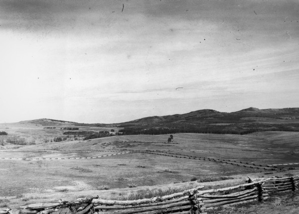
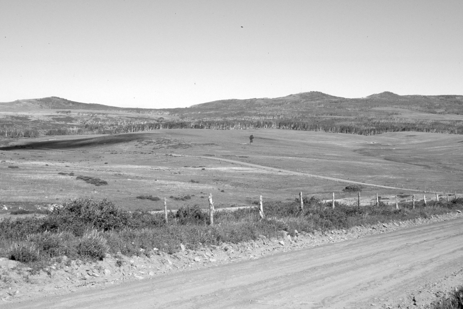
Plate 1310X. Shiver Creek 1939 – 2006 Viewed northwest across the head of Shiver Creek on Cedar Mountain. Co-op Knoll (9,775 ft) is on the left skyline, while Pine Spring Knoll (10,023 ft) is further to the right. All the wooden rail fences have been replaced with ones of woven wire. The shrubs are mostly snowberry and currants. Aspen has not successfully regenerated in many years due to excessive ungulate herbivory (Ohms 2003). Conifers have increased on the distant knolls. These private rangelands are grazed primarily by domestic sheep.
Photo Information:
Original photograph taken by Gregory (No. 887) in 1939; retake by Charles E. Kay on July 12, 2006 - - Photo No. 5683-20A. Original photograph held by the U.S. Geological Survey Photographic Library, Denver, CO.
Vegetative Community:
Aspen, Dry Meadow
Location:
South West: Section 18, Range 10 West, Township 38 South; UTM 328000 E, 4152400 N; elevation 9,300 ft.