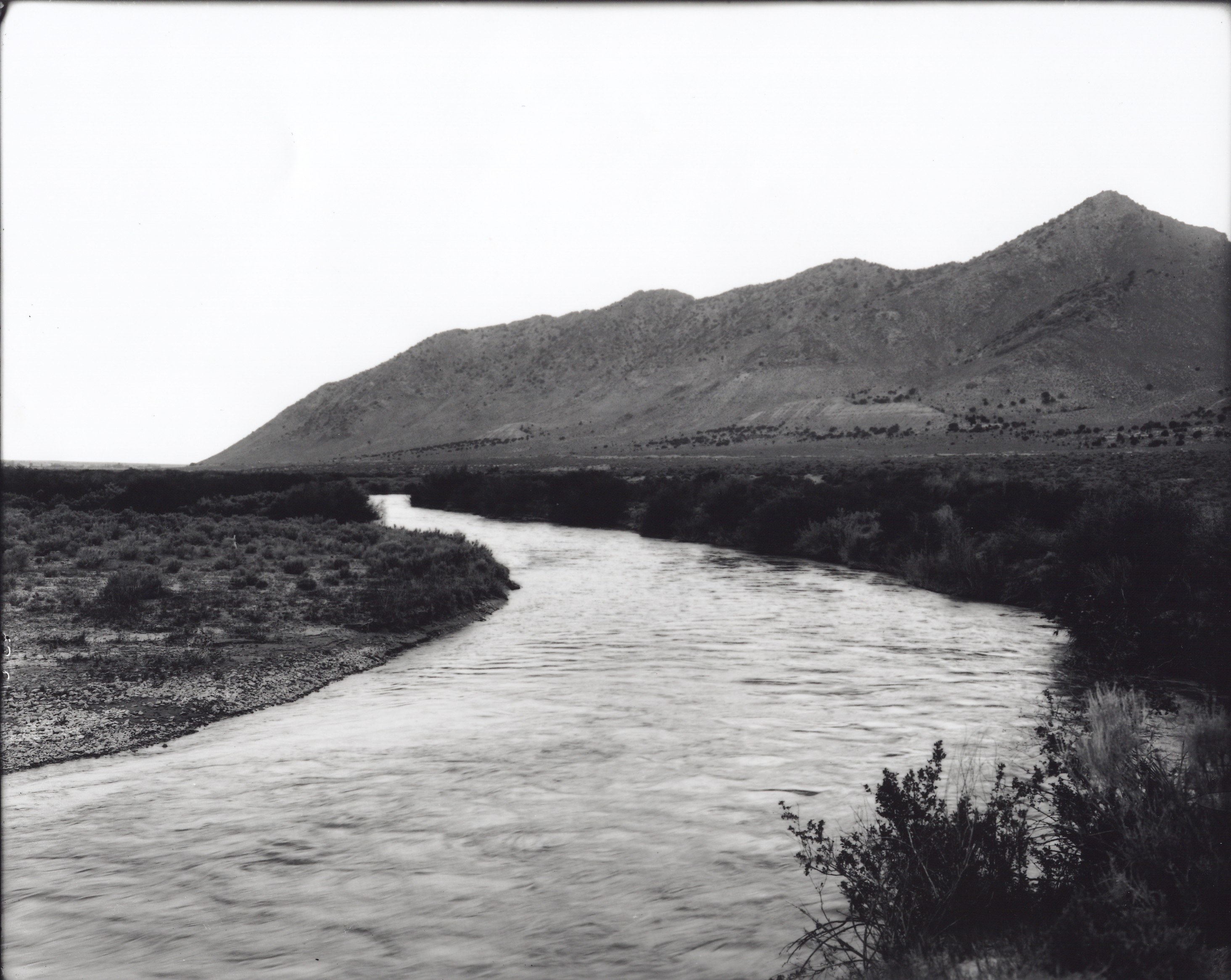
Sevier River
1909
2001
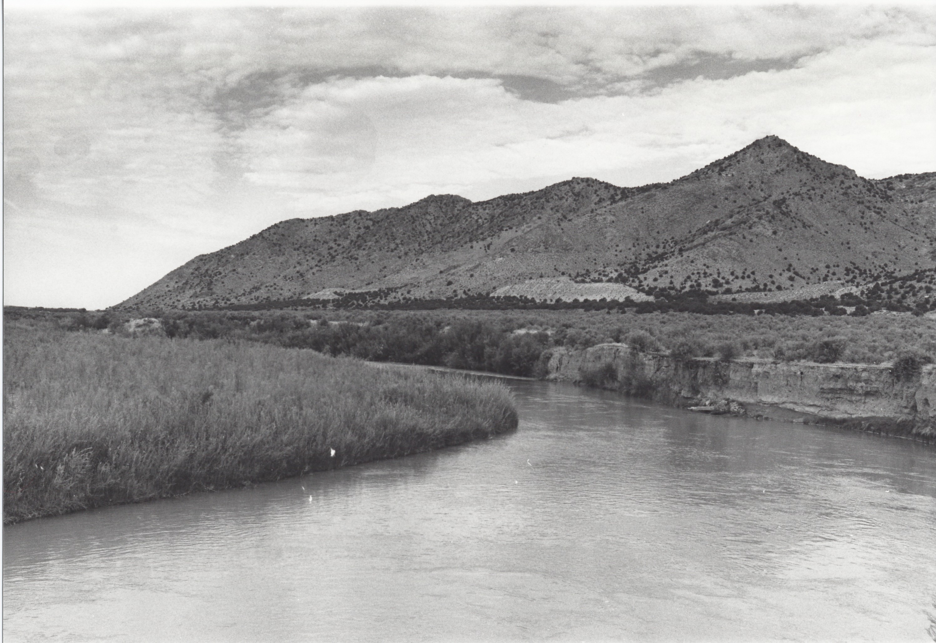
Description:
Plate 355. SEVIER RIVER LEAMINGTON CANYON 1909-2001 Plates 354 and 355 were taken from the same camera station. Plate 355 is viewed west-northwest (down stream) to the Gilson Mountains. The river has eroded the original photopoint, so the retakes were made approximately 100 feet down stream (north). The river has continued to erode its outside bank (photo-right), while deposition has occurred on the inside bank (photo-left), which is a normal process. Where the banks are stable or agrading, woody riparian vegetation, mostly willows, has increased. Pinyon-juniper on the more distant hillside has also increased. The land along the river is private.
Photo Information:
Original photo taken on June 7, 1909; retake by Charles E. Kay on August 31, 2001 - - Photo No. 4892-19; Original photo (No. 24455) held by Utah Historical Society, Salt Lake City, UT.
Vegetative Community:
Riparian, Pinyon, Juniper
Location:
South Central: Section 6, Range 3 W, Township 15 S; UTM 394600 E, 4378700 N; elevation 4,740 ft.