Sevier River
1936

2004
Description:
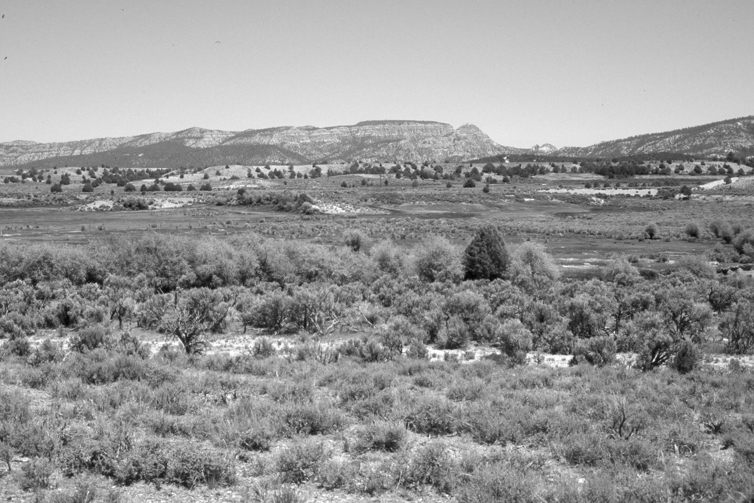
Plate 487X. Sevier River 1936 – 2004 Viewed northeast across the Sevier River about two miles north of Hatch, UT. Wilson Peak (9,034 ft.) is on the skyline. Woody riparian vegetation, primarily willows and Russian olive, have increased along the Sevier River, which has experienced a major channel change - - the meander loop seen in the 1936 image has now been abandoned. Pinyon and juniper have increased. Some willows on the seep areas beyond the river have declined. Sagebrush and rubber rabbitbrush occupy drier sites. The road and fence in the foreground have been realigned.
Photo Information:
Original photograph taken by H.E. Gregory (No. 769) in 1936; retake by Charles E. Kay on June 8, 2004 - - Photo No. 5337-8. Original photograph held in the U.S. Geological Survey Photograph Library, Denver, CO.
Vegetative Community:
Riparian, Pinyon, Juniper, Sagebrush
Location:
South West: Section 15, Range 5 West, Township 36 South; UTM 376400 E, 4170500 N; elevation 6,850 ft.