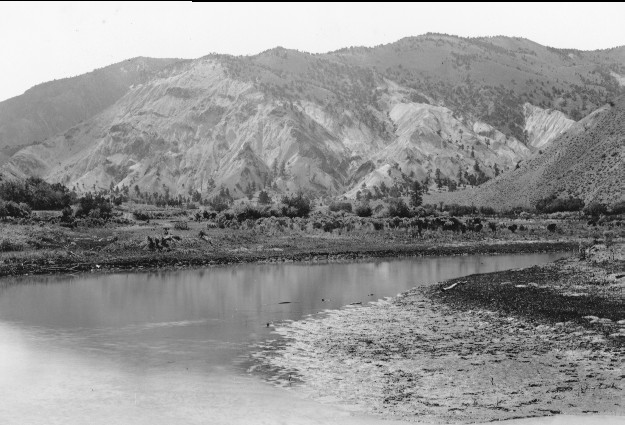
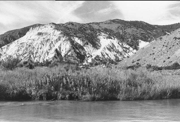
Sevier River
1885
1999
Description:
Plate 69. SEVIER RIVER: ca. 1885 - 1999 U.S. Highway 89 runs along the base of Big Rock Candy Mountain in the 1999 photo. The foreground is private and was heavily grazed during the 1800's. Although the river channel has changed and the exact photo point could not be relocated, that area is covered with riparian vegetation in the 1999 photo, which is not the case in the 1885 photo. Ponderosa pine (Pinus ponderosa) at the base of the mountain appears largely unchanged between the two photos; however pinyon (Pinus edulis) and juniper (Juniperus sp.) have increased over the years, especially above and to the west of Big Rock Candy Mountain (upper center of photo). Lacking access, it is unlikely early settlers deforested those hillsides . Apparently pinyon and juniper has spread over the years replacing once open areas.
Photo Information:
1885 photo taken by Charles R. Savage and held by LDS Church Historical Archives [P500-folder 78], Salt Lake City, UT; 1999 photo is Kay #4456-5, taken on July 27
Vegetative Community:
Riparian, Conifer, Pinyon, Juniper
Location:
South Central: T26S, R4W, Sect.20, UTM 4264250 N, 389750 E; elevation 5,600 ft., viewed southwest toward Big Rock Candy Mountain.