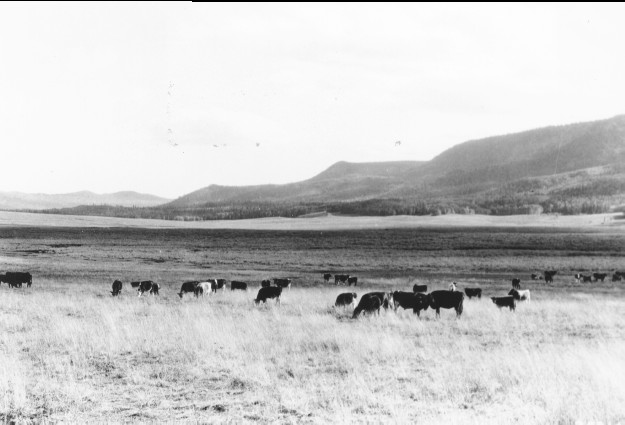
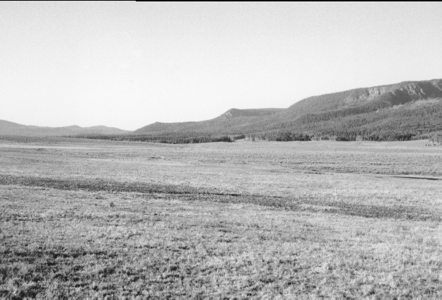
Sevenmile Valley
1930
1996
Description:
Plate 26. SEVENMILE VALLEY: 1930 - 1996 This photo point is similar to Plate 25 except the view is more to the south. The sub-irrigated meadow in the foreground appears more heavily grazed in the 1996 photo than in the 1930 photo. Silver sage (Artemisia cana) in the rest of the valley appears unchanged. On the more distant hillsides conifers have increased markedly, while aspen (Populus tremuloides) has declined, as would be expected in the absence of fire. The cut-banks and eroded areas in the 1930 photo appear largely unchanged. Many of the conifers on the distant hillside in the 1996 photo are being killed by insect and disease.
Photo Information:
1930 photo [#253147] taken by the Forest Service; 1996 photo is Kay #4027-30 taken on Aug. 3. Forest Service photo held by the National Agricultural Library, Washington D.C., and the Forest Service Regional Office Photographic Collection [2200 Fishlake-11] housed at Weber State University, Ogden UT.
Vegetative Community:
Wet Meadow, Sagebrush, Conifer, Aspen
Location:
South Central: Fishlake N.F., Loa R.D., T24S, R2E., Sect. 27, UTM 4281900 N, 441100 E; elevation 9,450 ft.; view to south.