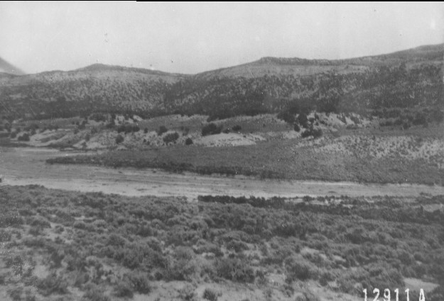
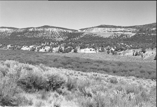
Salina Creek
1912
1999
Description:
Plate 102. SALINA CREEK: 1912 - 1999 The flood plain appears barren and eroded in the 1912 photo; in the 1999 photo it is covered by a dense growth of 10 to 15 foot tall willows (Salix spp.). The riparian area is in excellent condition in 1999, with beaver common. Sagebrush (Artemisia tridentata) in the foreground also appears healthier than in 1912. Pinyon (Pinus edulis) and juniper (Juniperus sp.) across the creek appear significantly more abundant in 1999 than in the 1912 photo, even on the dry southwest facing slopes. The 1999 photo shows Forest Service Road 010 which accesses a new coal mine.
Photo Information:
1912 photo is U.S. Forest Service #12911A taken on Aug. 6; 1999 photo is Kay #4474-28, taken on Aug. 13. Forest Service photo held by the Forest Service Regional Office Photographic Collection [2210 Fishlake-12] housed at Weber State Univ., Ogden, UT
Vegetative Community:
Riparian, Sagebrush, Pinyon, Juniper
Location:
South Central: Fishlake National Forest, Richfield Ranger District, T22S, R3E, Sect. 23, UTM 4304020 N, 452975 E; elevation 6,870 ft., viewed to northeast.