Salina Creek
1923
1996

Description:
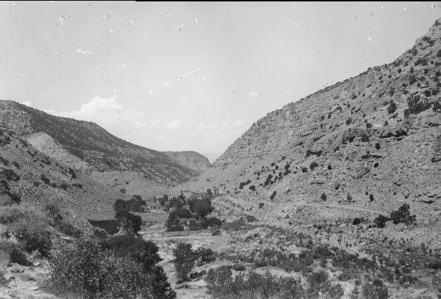
Plate 40. SALINA CREEK: 1923 - 1996 The 1923 photo point in now blocked by trees requiring that the 1996 photo be taken approximately 100 feet west. The view is down Salina Creek and shows how construction of Interstate Highway I-70 has altered the canyon bottom. The stream was eroding its banks and down cutting in 1923, while in 1996 most of the creek has been channelized to accommodate I-70; this has led to even greater bank erosion. Cottonwoods (Populus sp.) in the 1923 photo have largely been destroyed, but new trees have become established. There are a few additional pinyon (Pinus edulis) and juniper (Juniperus sp.) on the south-facing canyon walls (1996 photo at right) but otherwise very little change in plant communities is apparent. On the north-facing side of the canyon, however, pinyon and juniper has increased, as would be expected in the absence of fire.
Photo Information:
1923 photo taken by Spieker #76; 1996 photo is Kay #4077-14, taken on Sept, 26. Spieker photo held by the U.S. Geological Survey Photographic Archives, Denver CO.
Vegetative Community:
Juniper, Pinyon, Riparian
Location:
South Central: Below Dead Horse Canyon, Fishlake N.F, Richfield R.D., T22S, R2E., Sect. 15, UTM 4305850 N, 441600 E; elevation 6,200 ft.; view to west.