Salina Canyon
1923
2001
Description:
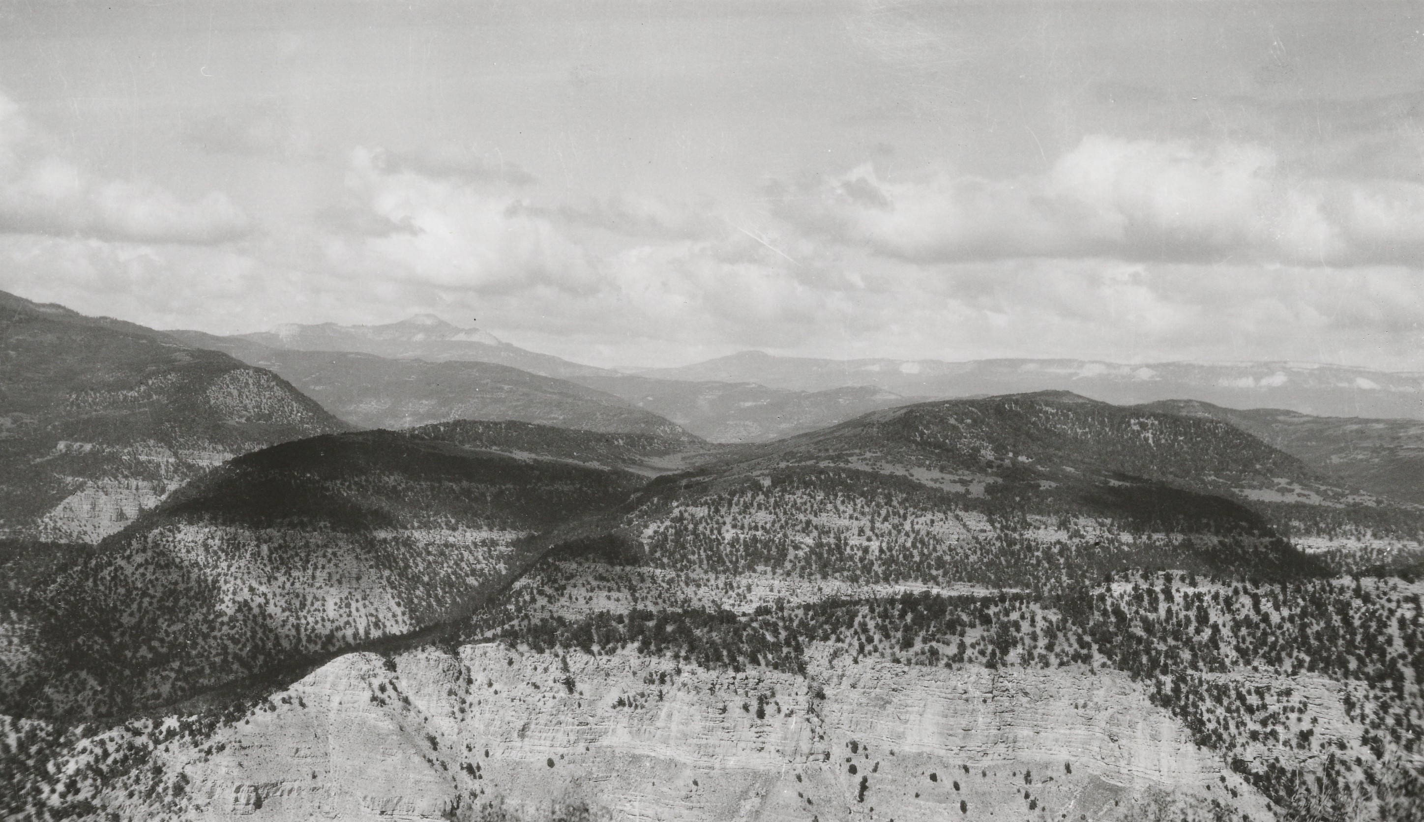
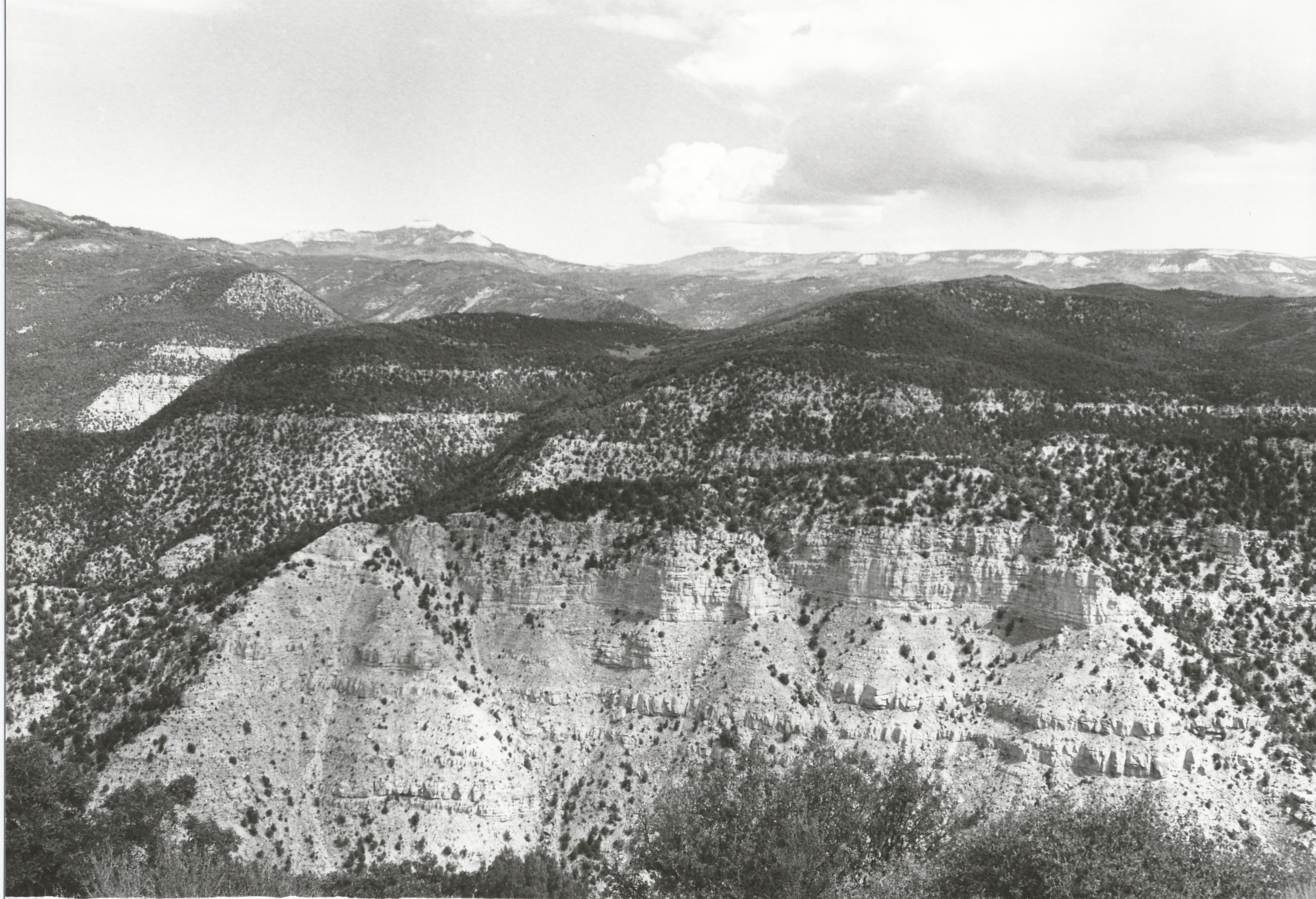
Plate 342. SALINA CANYON 1923-2001 Plates 340 to 342 form a panorama down and across Salina Canyon. All three photographs were initially taken from one camera station, but the retakes had to be made from different photopoints because dense brush obscured the original views. Plate 342 is viewed northeast across Salina Canyon to Water Hollow, Cool Hollow, and Water Hollow Ridge. Musina Peak (10,984 ft - - a.k.a. Marys Nipple) is on the skyline - - photo left center. Pinyon and juniper have increased as has oakbrush, serviceberry, birch-leaf mountain mahogany, curlleaf mountain mahogany, and other mountain brush species. The vegetation around the photopoint is now so thick that access is nearly impossible. Even the old mine road is now so overgrown that foot travel is difficult.
Photo Information:
Original photo by E.M. Spieker in 1923; retake by Charles E. Kay on August 29, 2001 - - Photo No. 4887-4A; Original photo (Spieker 79a) held by U.S. Geological Survey Photographic Library, Denver, CO.
Vegetative Community:
Pinyon, Juniper, Oakbrush, Mountain Brush
Location:
South Central: Section 24, Range 3 E, Township 22 S; UTM 445600 E, 4304350 N; elevation 7,800 ft.