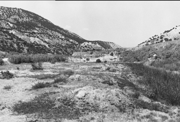
Salina Canyon
1920
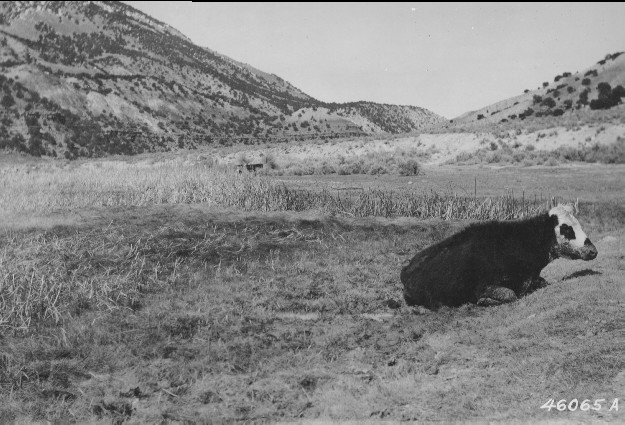
2000
Description:
Plate 222. SALINA CANYON 1920-2000 Viewed west down Salina Canyon above Rattlesnake Point. The cow in the original photograph had just been pulled from the bog and was too weak to get on her feet. The area has since been altered by construction of I-70. The photopoint is between the frontage road on the left and I-70 on the right. The swamp has been ditched, drained, and filled. Salina Creek is to the left of the frontage road and this bog was never part of the main stream channel. Pinyon and juniper have increased on the distant hillsides.
Photo Information:
U.S. Forest Service photo 46065A taken by H.E. Malmsten on April 24, 1920; retake by Charles E. Kay on July 31, 2000 - - Photo No. 4651-25; Original photo (2200 Fishlake-16-Misc/2-11) held by the Forest Service Regional Office Photographic Collection housed at Weber State University, Ogden, UT.
Vegetative Community:
Wet Meadow, Riparian, Pinyon, Juniper
Location:
South Central: Section 2, Range 1 E, Township 22 S; UTM 432850 E, 4308400 N; elevation 5,670 ft.