Roundup Flat
1953
2003
Description:
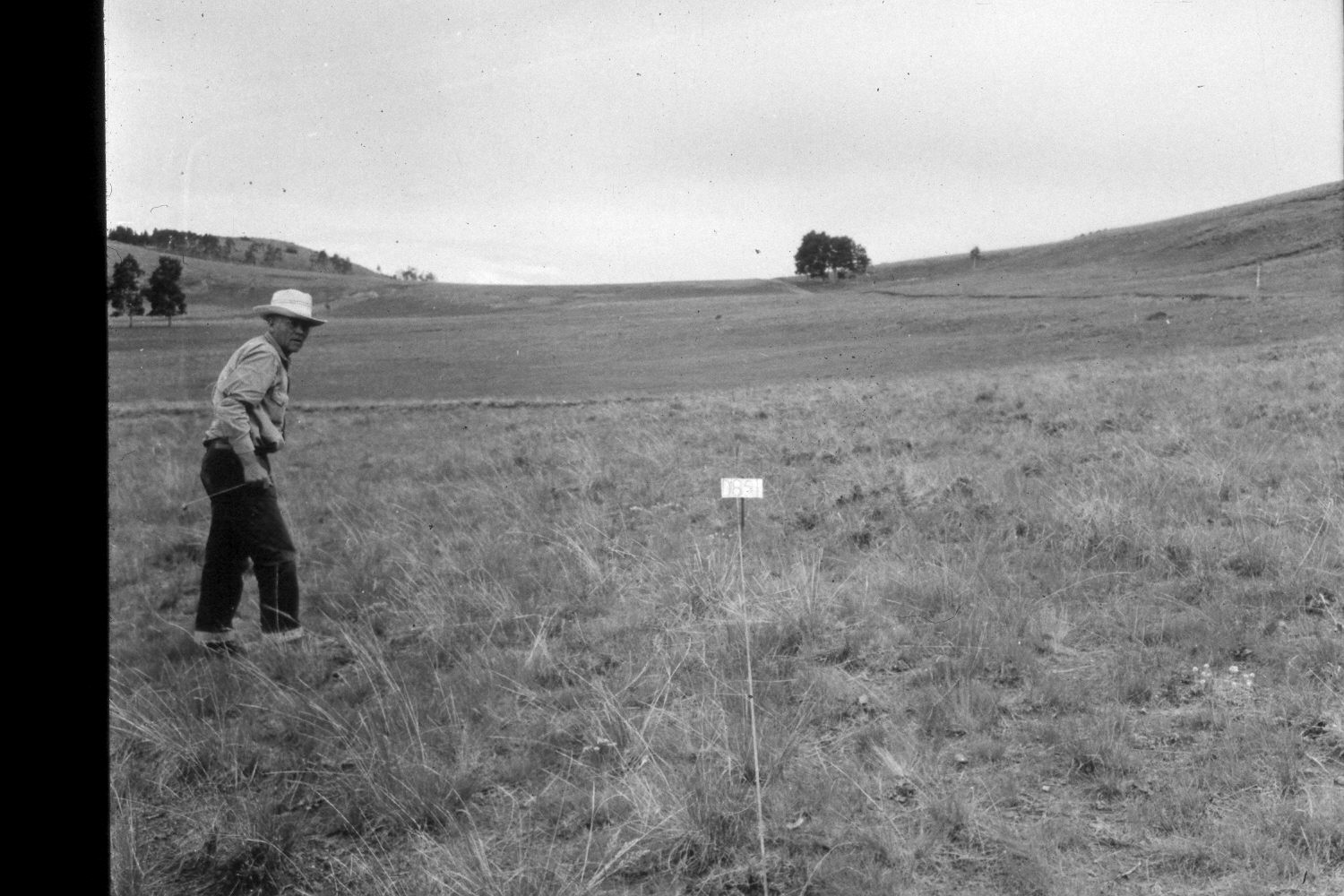
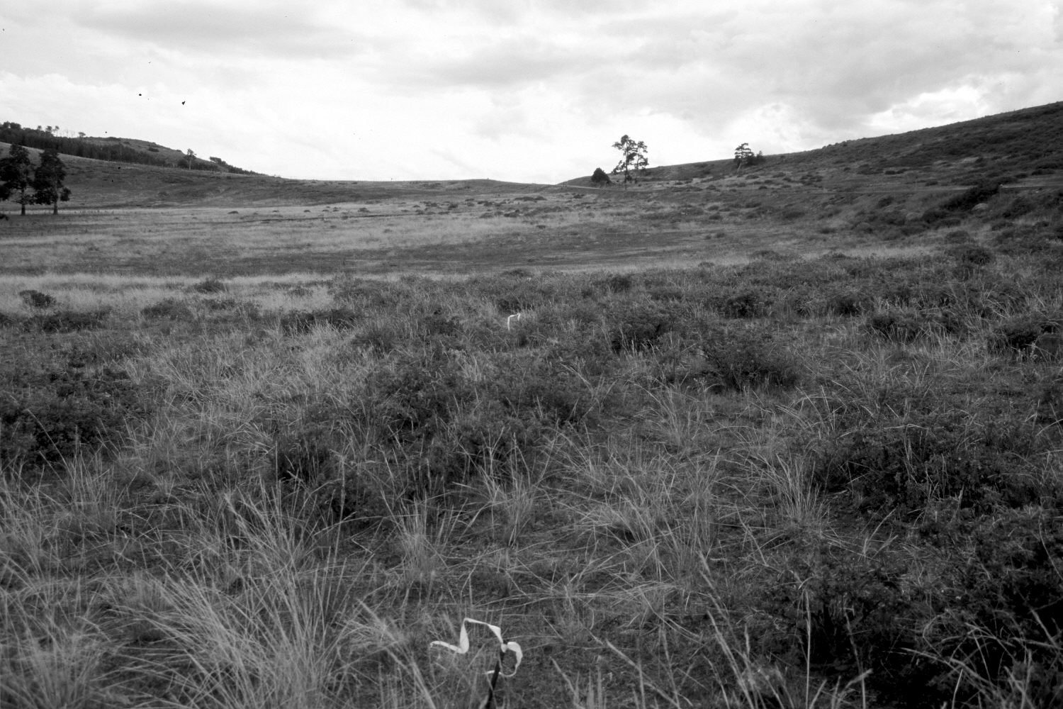
Plate 362X. Roundup Flat 1953 - 2003 Viewed southwest across Roundup Flat on the eastern flank of Boulder Mountain. The original image is part of an old, Parker 3-step range transect - - note the white flagging on the steel posts in the retake. Utah Highway 12, on the right, has been widened and paved. Snowberry has increased now that domestic sheep no longer use this allotment. The most common grass is needle and thread. The aspen clone on the left has not regenerated in more than 100 years, but other aspen stands regenerated about 30 years ago when mule deer numbers declined, but not before or since due to excessive browsing by wildlife and livestock (Kay and Bartos 2000).
Photo Information:
U.S. Forest Service photograph (unnumbered) taken by D. Semon on July 15, 1953; retake by Charles E. Kay on August 28, 2003 - - Photo No. 5263-28. Original photograph held in the range files on the Teasdale Ranger District, Dixie National Forest, Teasdale, UT.
Vegetative Community:
Aspen, Mountain Brush, Dry Meadow
Location:
South West: Section 11, Range 5 East, Township 32 South; UTM 471300 E, 4210200 N; elevation 9,540 ft.