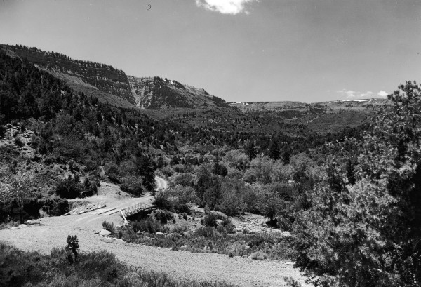
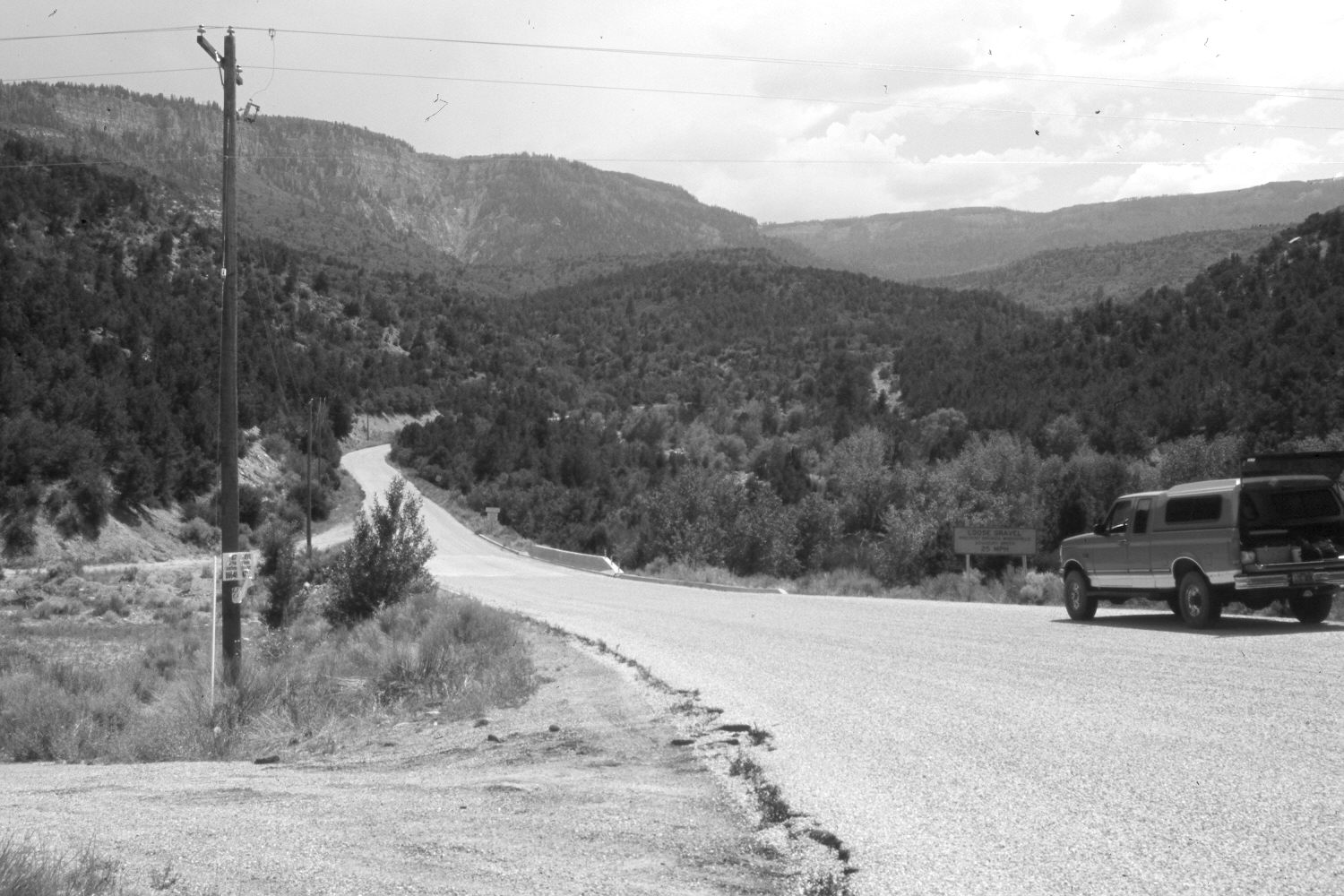
Right Hand Creek
1941
2006
Description:
Plate 1350X. Right Hand Creek 1941 – 2006 Viewed south up Right Hand Creek at its confluence with Coal Creek. Utah Highway 14, as well as the Cedar Mountain Road up Right Hand Creek, have been realigned, widened, and paved destroying the original camera station. Woody riparian vegetation appears to have increased as have pinyon, juniper, oakbrush, and other mountain brush species. In the distance, conifers have increased, while aspen has declined.
Photo Information:
U.S. Forest Service photograph (410797) taken by Paul Bieler in June 1941; retake by Charles E. Kay on July 17, 2006 - - Photo No. 5697-25. Original photograph held by Southern Utah University Archives and Special Collections, Cedar City, UT.
Vegetative Community:
Riparian, Pinyon, Juniper, Conifer, Mountain Brush
Location:
South West: Section 24, Range 10 West, Township 36 South; UTM 324800 E, 4168975 N; elevation 6,510 ft.