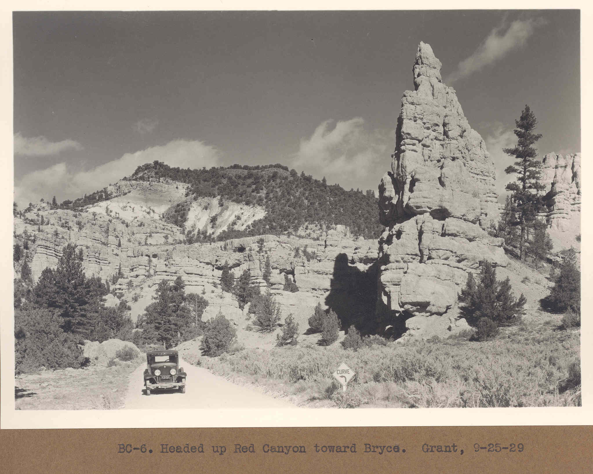
Red Canyon
1929
2006
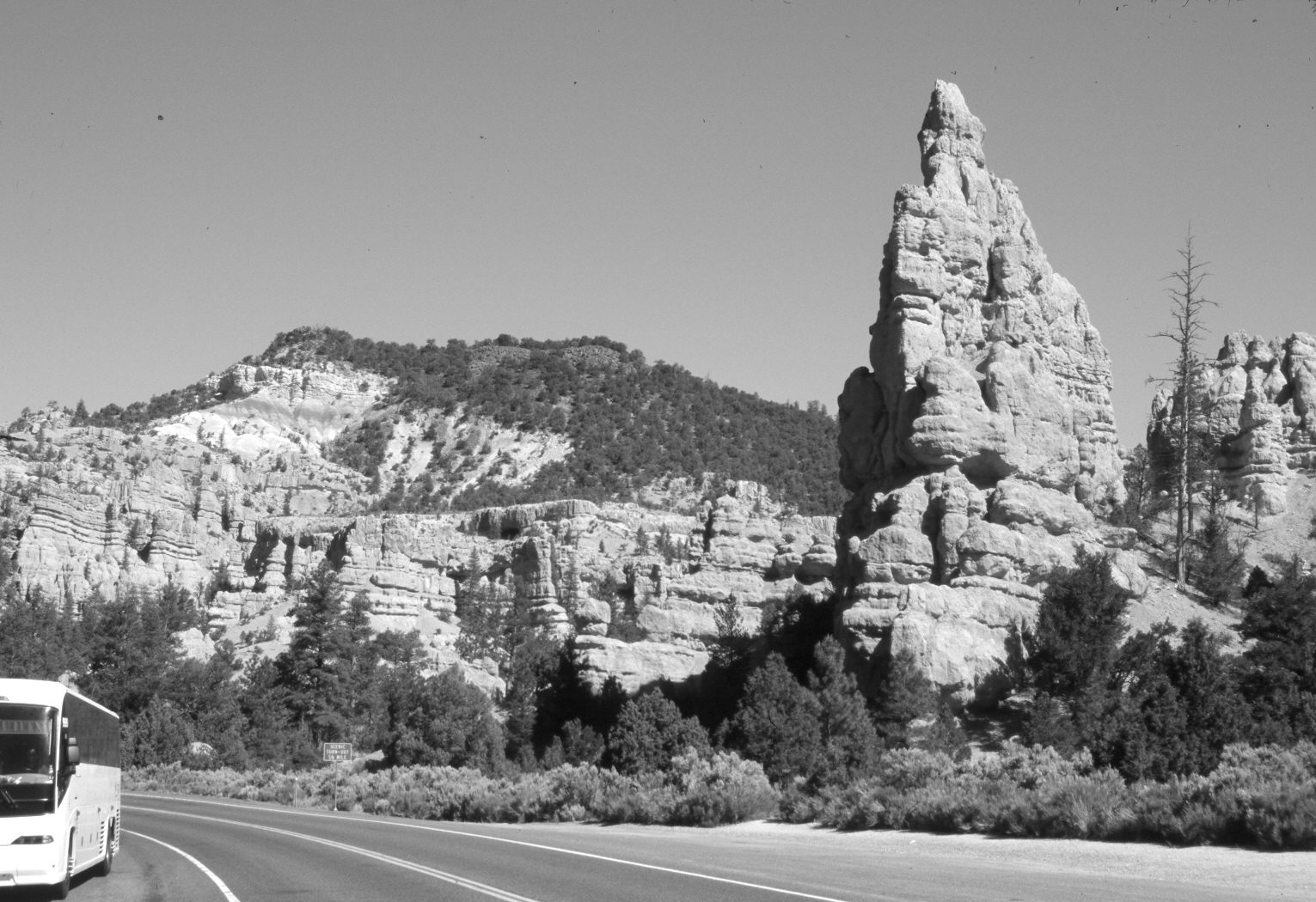
Description:
Plate 1243X. Red Canyon 1929 – 2006 Viewed west-northwest down Red Canyon just below the Forest Service Visitor Center. Utah Highway 12 has been widened and paved. Pinyon, juniper, and ponderosa pine have increased. For a slightly different view of the same area see Plate 144x.
Photo Information:
Original photograph taken by Grant (BC-6) on September 25, 1929; retake by Charles E. Kay on June 22, 2006 - - Photo No. 5658-6. Original photograph (Zion 12366) held by the National Park Service, Zion National Park, Springdale, UT.
Vegetative Community:
Pinyon, Juniper, Conifer
Location:
South West: Section 27, Range 4½ West, Township 35 South; UTM 384100 E, 4178000 N; elevation 7,200 ft.
January 2018