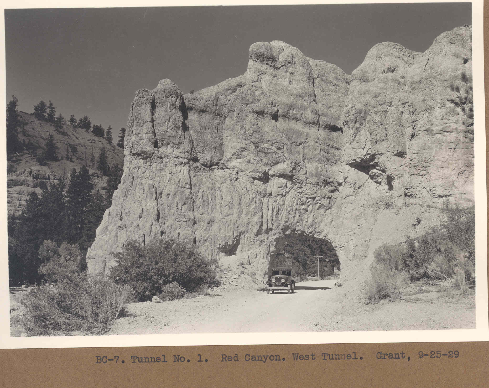
Red Canyon
1929
2006
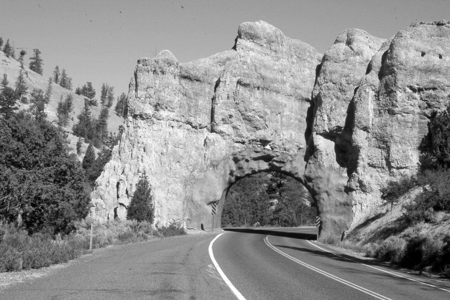
Description:
Plate 1242X. Red Canyon 1929 – 2006 Viewed west to the western-most tunnel in Red Canyon. Utah Highway 12 has been widened and paved. Pinyon, juniper, and ponderosa pine have increased. Plates 132x and 133x show the opposite face of this tunnel.
Photo Information:
Original photograph taken by Grant (BC-7) on September 25, 1929; retake by Charles E. Kay on June 22, 2006 - - Photo No. 5658-3. Original photograph (Zion 12366) held by the National Park Service, Zion National Park, Springdale, UT.
Vegetative Community:
Pinyon, Juniper, Conifer
Location:
South West: Section 26, Range 4½ West, Township 35 South; UTM 385700 E, 4177500 N; elevation 7,400 ft.
January 2018