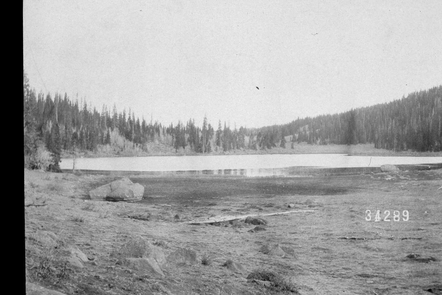
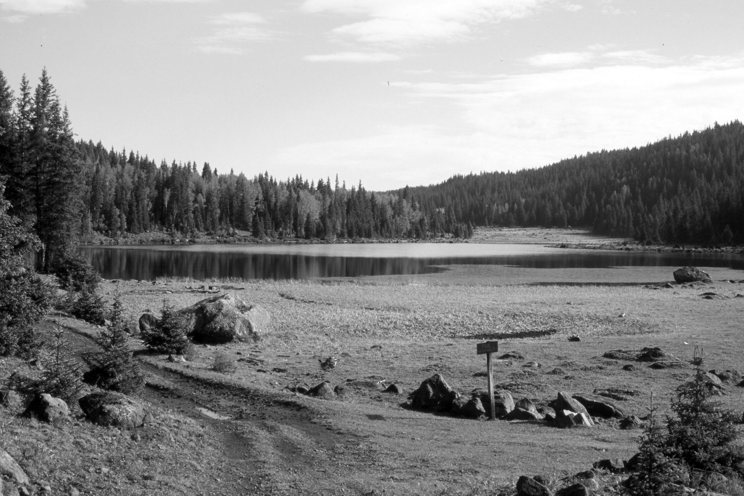
Purple Lake
1902
2002
Description:
Plate 93X. Purple Lake 1902-2002 Viewed north-northeast across Purple Lake on the western edge of the Aquarius Plateau (a.k.a. Boulder Top). The boulders in the foreground were disturbed when the road was constructed around the lake. The area has heavily grazed by cattle in 2002 and appears to have been even more heavily grazed in 1902, probably by sheep. Conifers, primarily spruce, have increased despite selective logging, while aspen has declined. All aspen stands have been heavily invaded by conifers. Aspen was short-statured in the original and regenerating, but most aspen stands have not regenerated since that time. The lake level in 2002 appears similar to that 100 years earlier despite the recent drought that has gripped southern Utah for several years.
Photo Information:
U.S. Forest Service photograph 34289 taken by A.F. Potter on October 19, 1902; retake by Charles E. Kay on August 3, 2002 - - Photo No. 4998-31. Original photograph held by Southern Utah University Archives and Special Collections, Cedar City, UT.
Vegetative Community:
Riparian, Conifer, Aspen
Location:
South West: Section 33, Range 3 East, Township 31 South; UTM 449800E, 4213900N; elevation 10,550 ft.