Proctor Creek
1936
2004
Description:
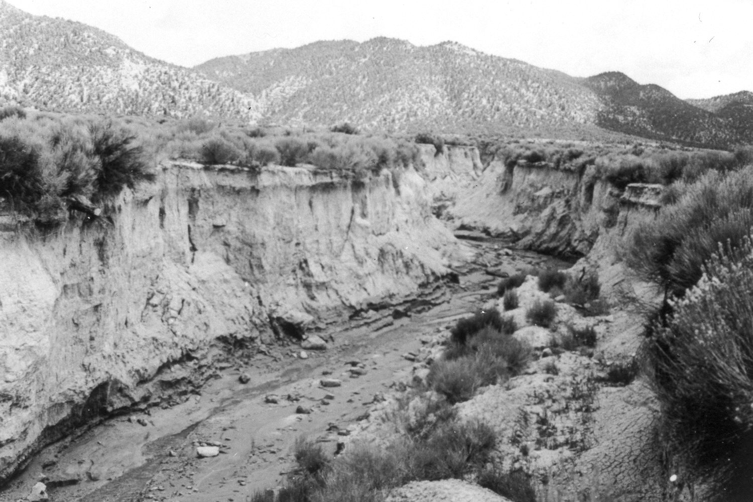
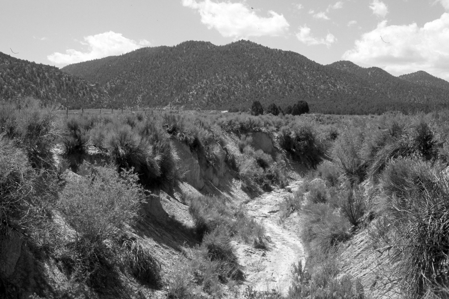
Plate 493X. Proctor Creek 1936 – 2004 Viewed southeast up Proctor Creek to the mouth of Proctor Canyon on the Paunsaugunt Plateau. The channel walls have stabilized and naturally revegetated. The shrubs are mostly rubber rabbitbrush, but mountain big sage, rose, and willows are also present. Pinyon and juniper have increased. According to the caption on the original image, Proctor Creek cut this arroyo through a 1919 mudflow. In some parts of Proctor Canyon, the arroyo is 30 to 40 feet deep.
Photo Information:
U.S. Forest Service photograph (378495) taken by A.R.C. in July 1936; retake by Charles E. Kay on June 9, 2004 - - Photo No. 5339-4. Original photograph held by the Utah Historical Society, Reed W. Bailey Collection (Box 7, C-439), Salt Lake City, UT.
Vegetative Community:
Riparian, Sagebrush, Pinyon, Juniper
Location:
South West: Section 26, Range 5 West, Township 36 South; UTM 378900 E, 4167400 N; elevation 7,140 ft.