Pole Corral Draw
1935
2002
Description:
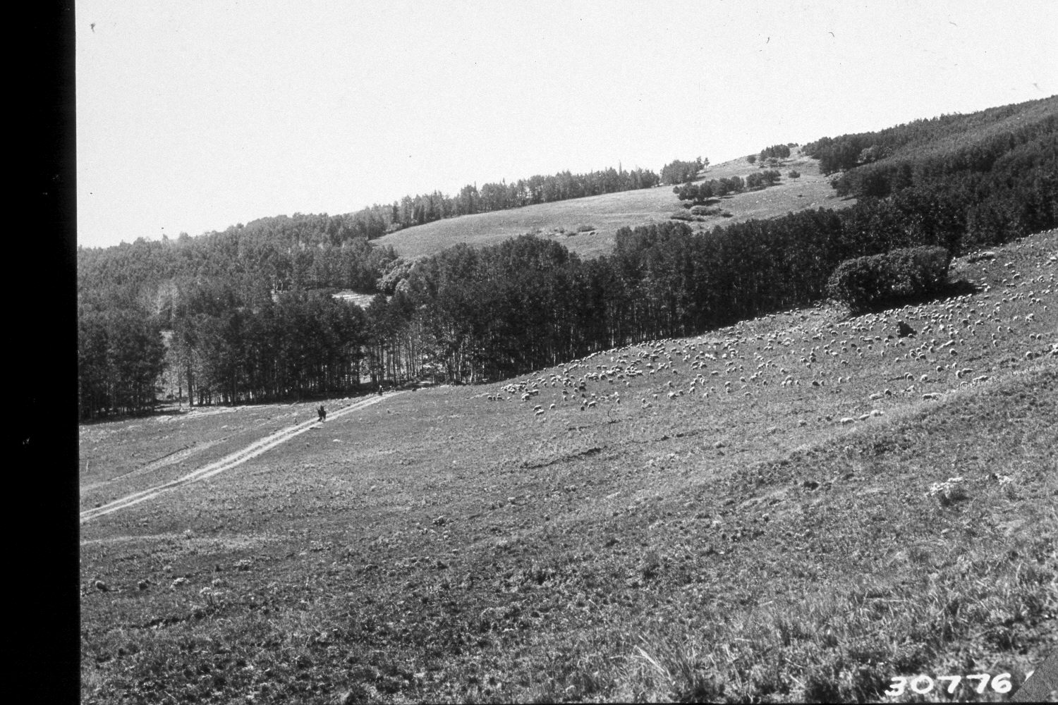
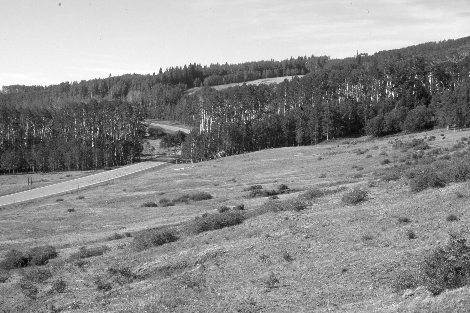
Plate 20X. Pole Corral Draw 1935-2002 Viewed southwest across the upper section of Pole Corral Draw on the eastside of Boulder Mountain. Note the horseman and domestic sheep in the original photograph, and how Utah Highway 12 has been improved and paved. This area is no longer grazed by sheep, but was heavily grazed by cattle in 2002. Shurbs, primarily snowberry (Symphoricarpos oreophilus), have increased in the foreground. Erosion channels were beginning to form in the original photograph and are now more deeply incised, though, active soil erosion has ceased. Most aspen stands successfully regenerated, without fire or other disturbance, during the late 1970’s from mule deer numbers declined (Kay and Bartos 2000). Aspen stands on the distant ridge have been invaded by conifers, but many clones have not. This is part of the climax aspen zone (Mueggler 1988) on the east and southeast flanks of Boulder Mountain.
Photo Information:
U.S. Forest Service photograph 307761 taken by K.D. Swan in August 1935; retake by Charles E. Kay on July 8, 2002 - - Photo No. 4959-32. Original photograph held by Southern Utah University Archives and Special Collections, Cedar City, UT.
Vegetative Community:
Mountain Brush, Aspen
Location:
South West: Section 2, Range 5 East, Township 32 South; UTM 471250E, 4211500N; elevation 9,520 ft.