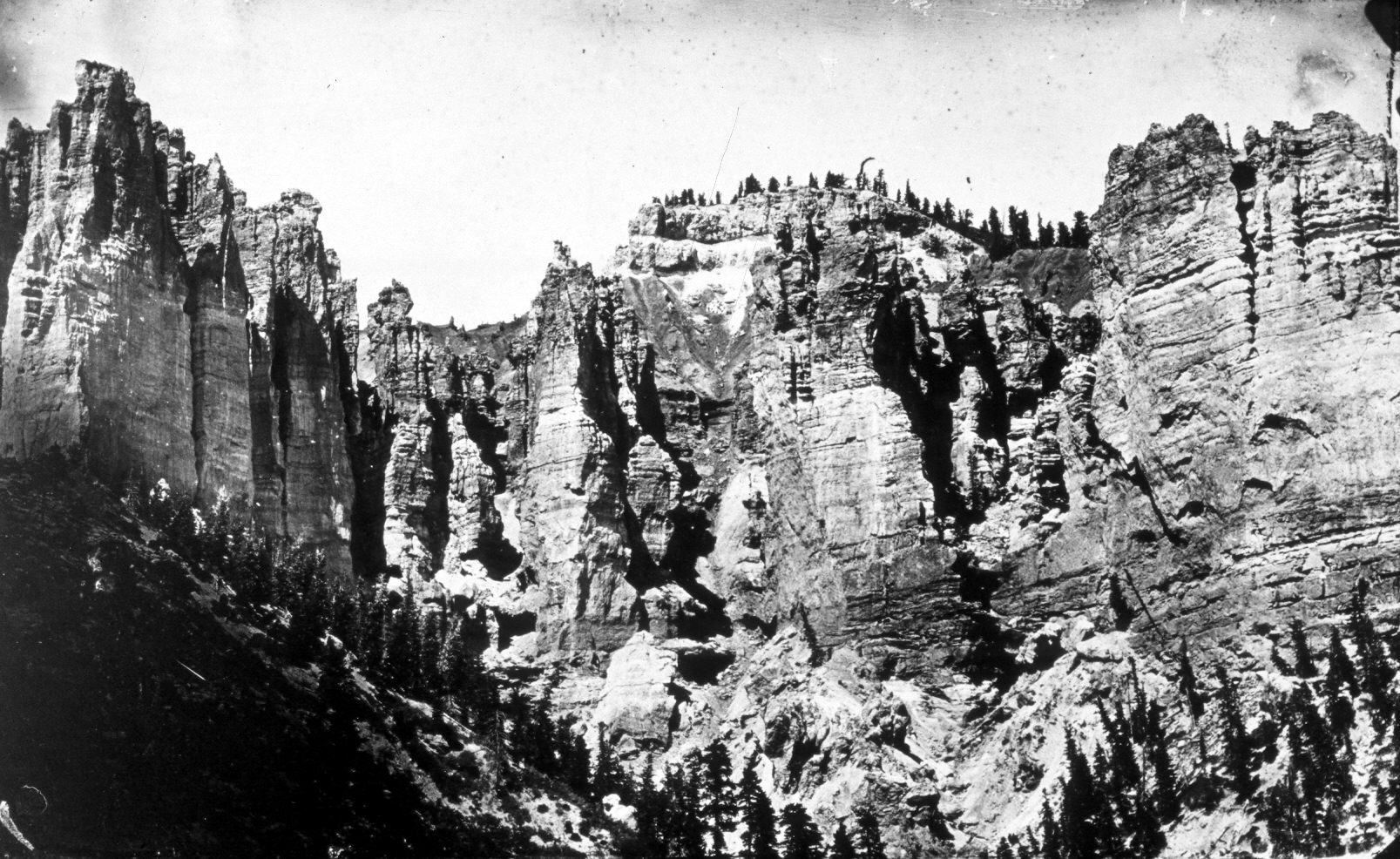
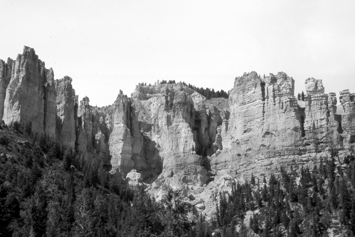
Pink Cliffs
1872
2004
Description:
Plate 515X. Pink Cliffs 1872 – 2004 Shown are the Pink Cliffs (9,394 ft.) at the head of Slide Canyon on the southern end of the Paunsaugunt Plateau. Plates 513x to 516x form a panorama from left to right. Plate 515x is viewed north-northeast. These are the same cliffs seen on the skyline in Plate 512x. The original camera station is blocked by white fir and juniper, so the retake was made from the nearest open area, which is approximately 100 feet forward (north), as well as a little lower. White fir, Douglas fir, pinyon, juniper, oakbrush, true mountain mahogany, squaw apple, Utah serviceberry, bitterbrush, snowberry, and greenleaf manzanita have all increased most markedly. Today, the area is a dense woody morass that is extremely difficult to negotiate, even on foot. To say that I swore once or twice reaching this photopoint would be a gross understatement. The dramatic increase in woody vegetation is directly attributable to the elimination of native burning and modern fire suppression. Needless to say, forest fuels have increased significantly and any fire that would start today would burn much more intense than what historically occurred. The rock formations show little apparent change.
Photo Information:
Original photograph taken by John Hillers (No. 468) in 1872; retake by Charles E. Kay on June 28, 2004 - - Photo No. 5349-12. Original photograph (057-PS-468) held in the National Archives, Washington, D.C.
Vegetative Community:
Conifer, Pinyon, Juniper, Oakbrush, Mountain Brush
Location:
South West: Section 24, Range 4½ West, Township 39 South; UTM 382900 E, 4141000 N; elevation 8,400 ft.