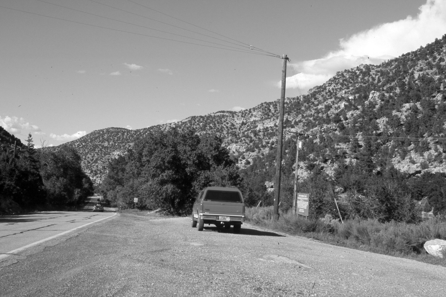
Parowan Canyon
1942
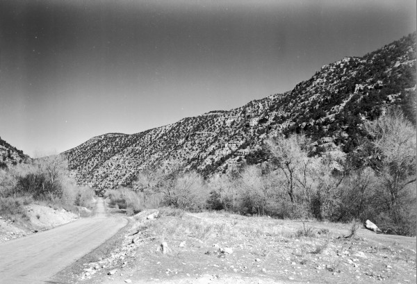
2006
Description:
Plate 1389X. Parowan Canyon 1942 – 2006 Viewed north-northeast down Parowan Canyon from just below First Left Hand Canyon. Cottonwoods, willows, and other woody riparian vegetation appear to have increased except on the right where the city of Parowan has built a small reservoir to feed its irrigation and electrical generation systems. Pinyon and juniper have increased. Utah Highway 143 has been widened and paved.
Photo Information:
Original photograph taken by Gregory (No. 1145) in 1942; retake by Charles E. Kay on August 5, 2006 - - Photo No. 5715-9. Original photograph held by the U.S. Geological Survey Photographic Library, Denver, CO.
Vegetative Community:
Riparian, Pinyon, Juniper
Location:
South West: Section 36, Range 9 West, Township 34 South; UTM 340200 E, 4184650 N; elevation 6,620 ft.