Paria River
1921
2004
Description:
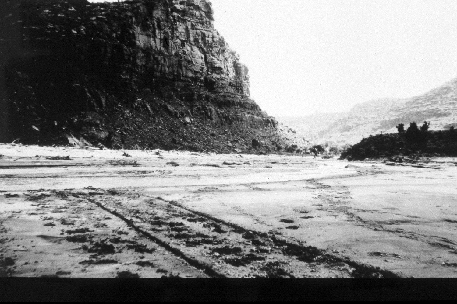
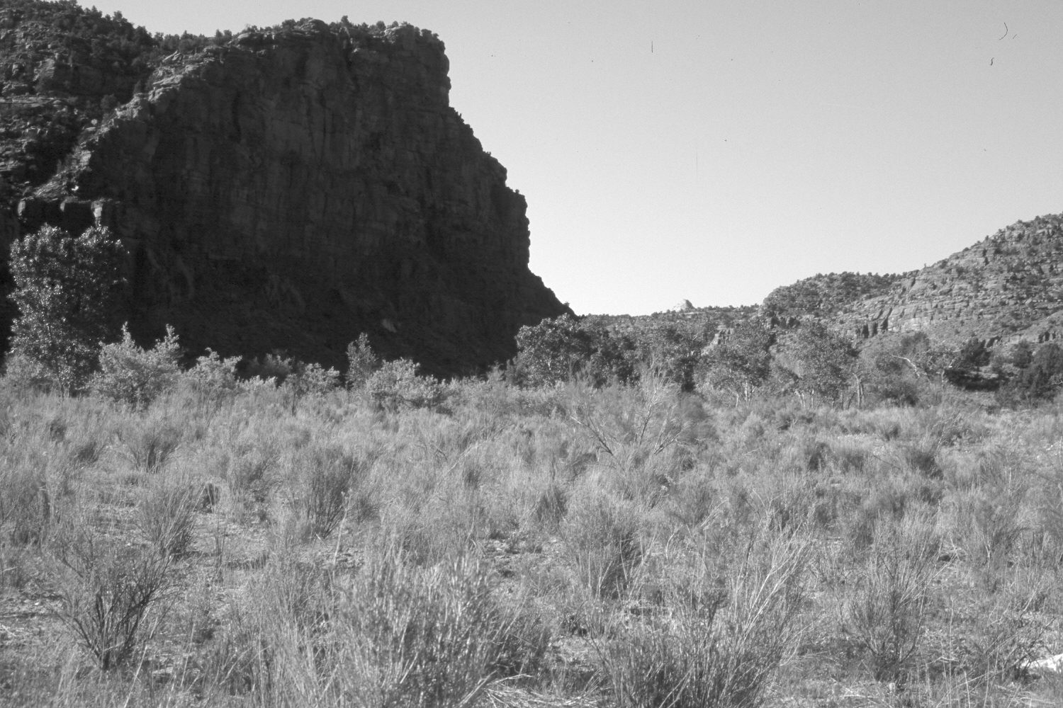
Plate 437X. Paria River 1921 – 2004 Viewed south down the Paria River approximately 3 miles above Kitchen Canyon. The active channel has narrowed and moved towards the base of the cliff on the left. The old floodplain has stabilized and revegetated. Cottonwoods, willows, tamarisk, and Russian olive now line the stream, while rubber rabbitbrush, green rabbitbrush, Indian rice grass, and cheatgrass are common on the drier parts of the floodplain. The area was actively being grazed by cattle in 2004. Note the wagon track and cattle in the original photograph. Early in the last century, freight was routinely hauled by ox-team up the river bed from Paria townsite to the Tropic Valley.
Photo Information:
Original photograph taken by R.C. Moore (No. 189) in 1921; retake by Charles E. Kay on May 15, 2004 - - Photo No. 5305-11A. Original photograph held by the U.S. Geological Survey Photographic Library, Denver, CO.
Vegetative Community:
Riparian, Dry Meadow
Location:
South West: Section 15, Range 2 West, Township 40 South; UTM 411100 E, 4132200 N; elevation 5,010 ft.