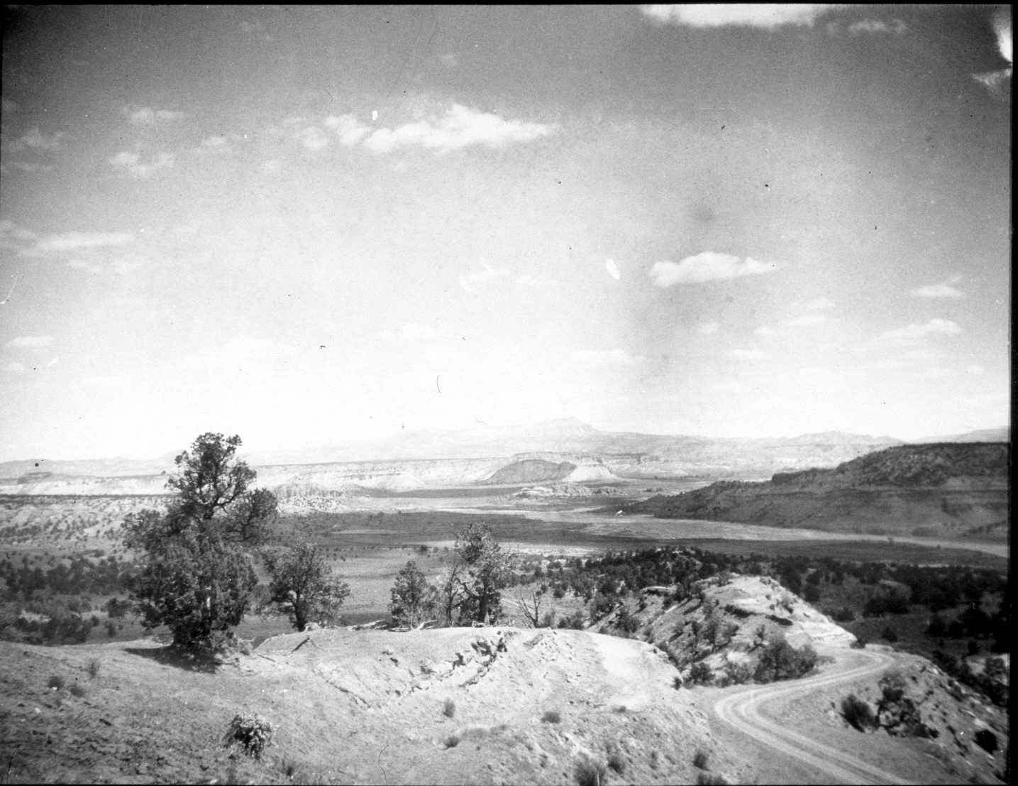
Paria River
1940
2004
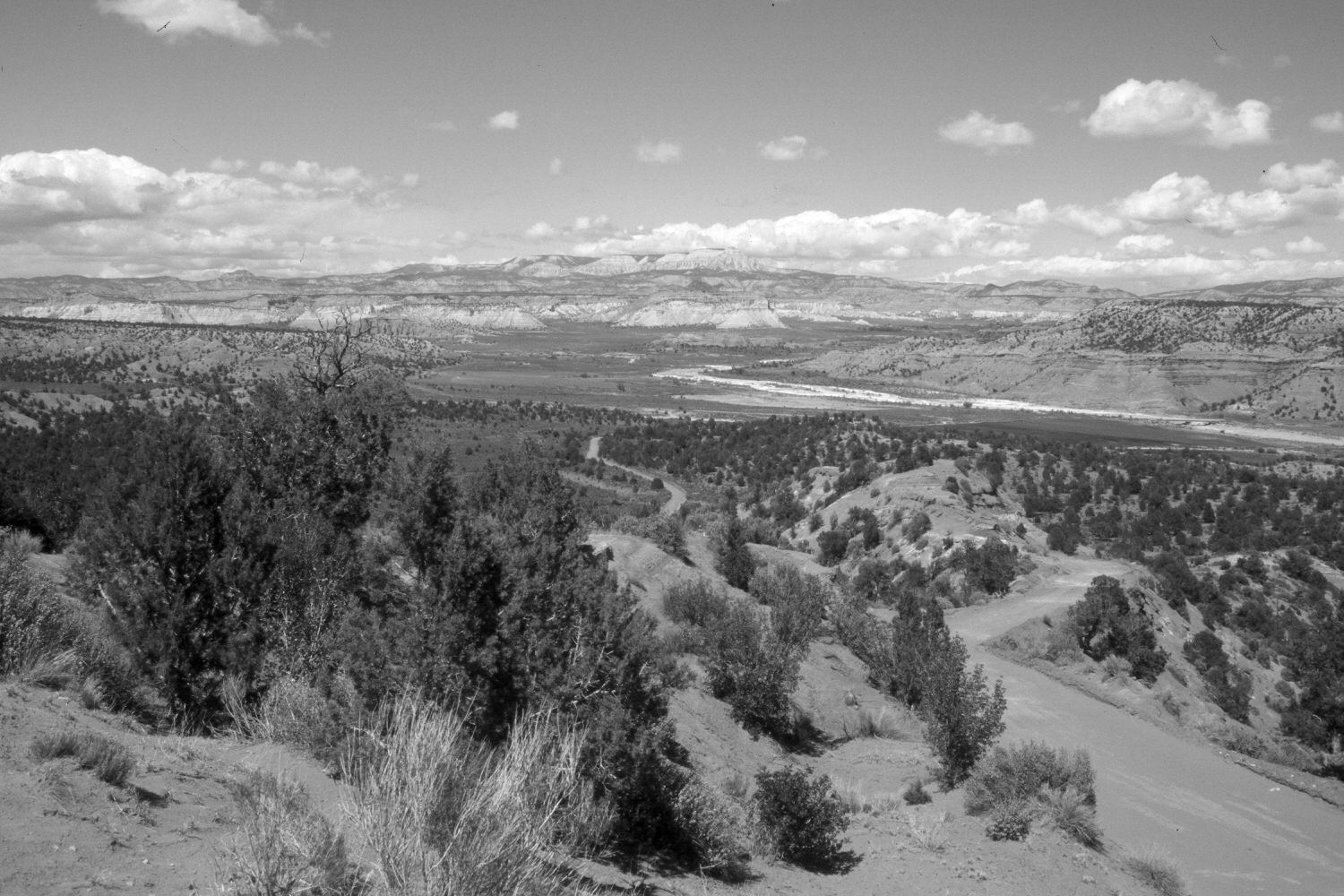
Description:
Plate 426X. Paria River 1940 – 2004 Viewed northeast up the Paria River. Yellow Creek enters on the left, while Henrieville Creek enters on the right. Powell Point (10,188 ft.) dominates the skyline. The Paria’s channel has narrowed and supports more woody riparian vegetation today than in the past. Pinyon and juniper have increased. The pinyon closest to the camera on the near ridge has died, but is still standing - - note the dead top above the newly established juniper. The road to Kodachrome Basin State Park has been paved and a new bridge constructed over the Paria - - photo right-center edge. Silverberry, single-seeded ash, and Utah serviceberry have increased in the foreground.
Photo Information:
Original photograph taken by H.E. Gregory (No. 983) in 1940; retake by Charles E. Kay on May 12, 2004 - - Photo No. 5299-16. Original photograph held by the U.S. Geological Survey Photographic Library, Denver, CO.
Vegetative Community:
Riparian, Pinyon, Juniper
Location:
South West: Section 12, Range 3 West, Township 38 South; UTM 406300 E, 4152750 N; elevation 6,060 ft.