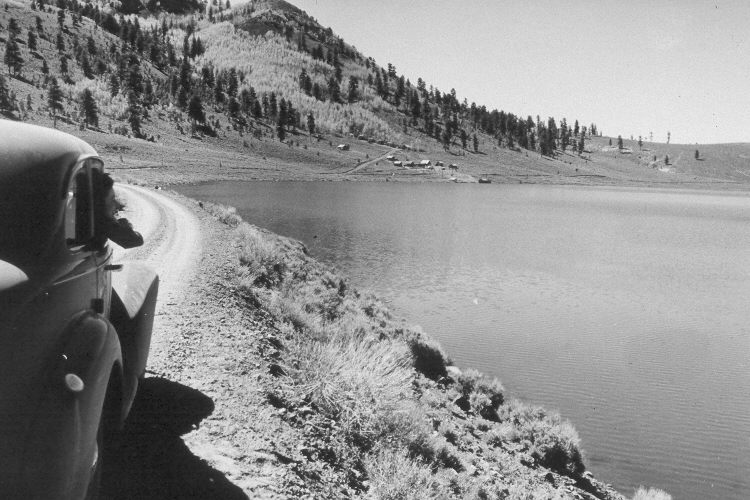
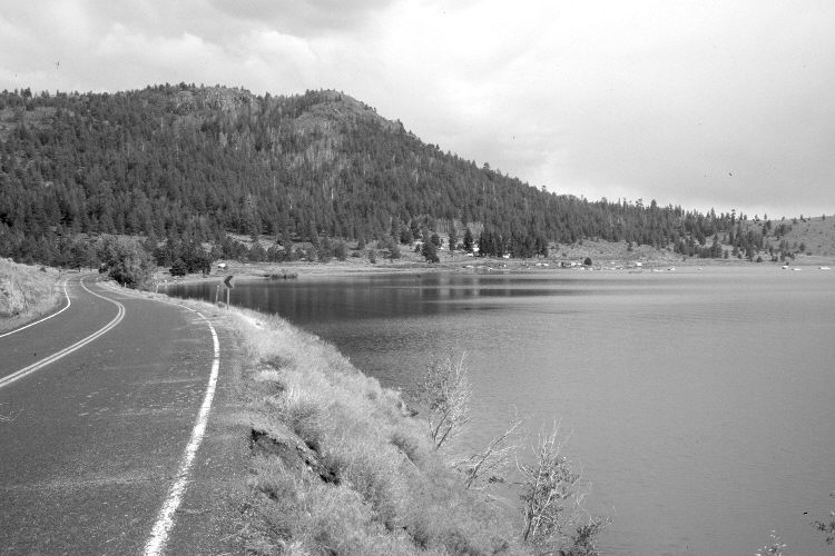
Panguitch Lake
1941
2005
Description:
Plate 1017X. Panguitch Lake 1941 – 2005 Viewed southeast along the eastern edge of Panguitch Lake to Copper Knoll (9,015 ft.) and Lakeview Resort. Utah Highway 143 has been widened and paved. Ponderosa pine, Douglas fir, spruce, and white fir have increased, while aspen has declined - - see Plates 1014x and 1041x.
Photo Information:
U.S. Forest Service photograph (410841) taken by Paul S. Bieler in June 1941; retake by Charles E. Kay on August 2, 2005 - - Photo No. 5509-24. Original photograph held by Southern Utah University Archives and Special Collections, Cedar City, UT.
Vegetative Community:
Conifer, Aspen
Location:
South West: Section 34, Range 7 West, Township 35 South; UTM 356800 E, 4175750 N; elevation 8,240 ft.
January 2018