Panguitch
1944
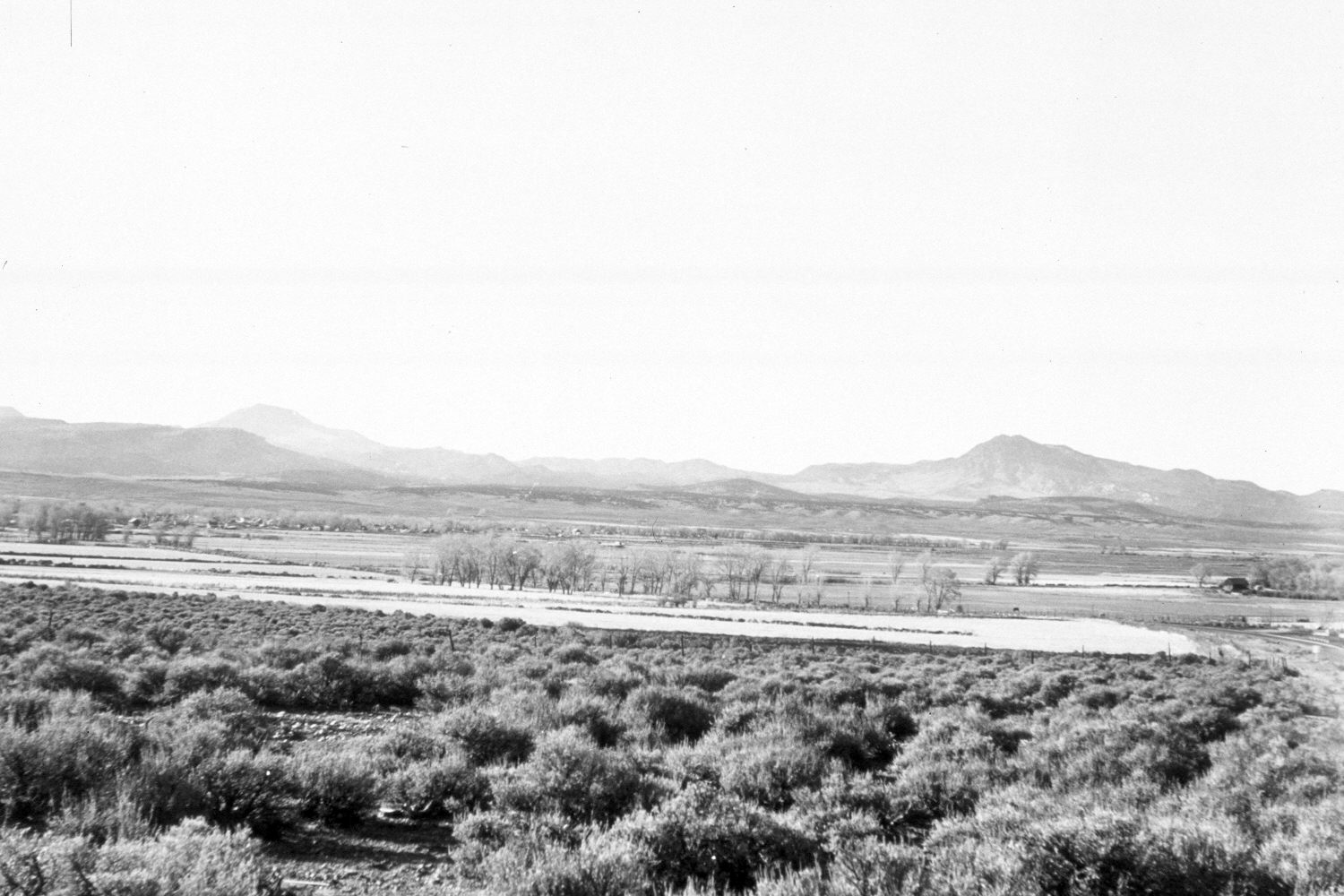
2004
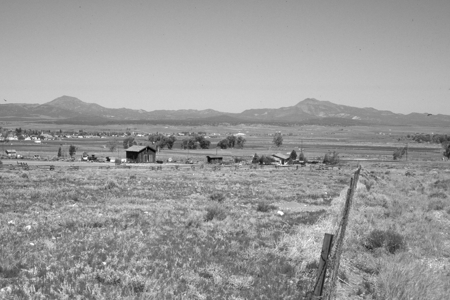
Description:
Plate 486X. Panguitch 1944 – 2004 Viewed northwest across the Sevier River Valley just south of Panguitch, UT. Circleville Mountain (11,285 ft.) is on the right skyline and Little Creek Peak (10,140 ft.) on the left. Cottonwoods have been removed as agricultural fields have been expanded. New sewage lagoons have been built east of Panguitch. U.S. Highway 89 has been realigned and new homes have been constructed. Pinyon and juniper have increased in the distance.
Photo Information:
Original photograph taken by H.E. Gregory (No. 1247) in 1944; retake by Charles E. Kay on June 8, 2004 - - Photo No. 5337-4. Original photograph held in the U.S. Geological Survey Photograph Library, Denver, CO.
Vegetative Community:
Pinyon, Juniper
Location:
South West: Section 27, Range 5 West, Township 34 South; UTM 376300 E, 4186500 N; elevation 6,760 ft.