Ormand Point
1935
2002

Description:
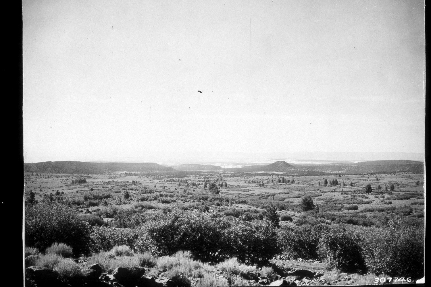
Plate 38X. Ormand Point 1935-2002 Viewed south to Ormand Point (7,543 ft.) above the town of Boulder, Utah. The Garkane Hydroelectric Plant is just off the photo to the left. The exact camera station could not be reoccupied due to the growth of woody vegetation, but the retake was made as close as possible to the original photopoint. Shown is the mountain brush zone that occurs above the pinyon-juniper zone, but below the ponderosa pine zone on the southside of Boulder Mountain. The tall shrubs are primarily oakbrush and Utah serviceberry with big sagebrush, bitterbrush (Purshia tridentata), and snowberry in the understory. Oakbrush and serviceberry have increased considerably, as has ponderosa pine. This site is slowly being converted into a pine forest. Note the cleared fields above the town of Boulder. The area had not been grazed by livestock in 2002 at the time the retake was made.
Photo Information:
U.S. Forest Service photograph 307746 taken by K.D. Swan in August 1935; retake by Charles E. Kay on July 9, 2002 - - Photo No. 4966-24. Original photo held by U.S. Forest Service Regional Photographic Collection (2310-Dixie-210) housed at Weber State University, Ogden, UT.
Vegetative Community:
Mountain Brush, Conifer, Sagebrush
Location:
South West: Section 27, Range 4 East, Township 32 South; UTM 461200E, 4205150N; elevation 7,980 ft.