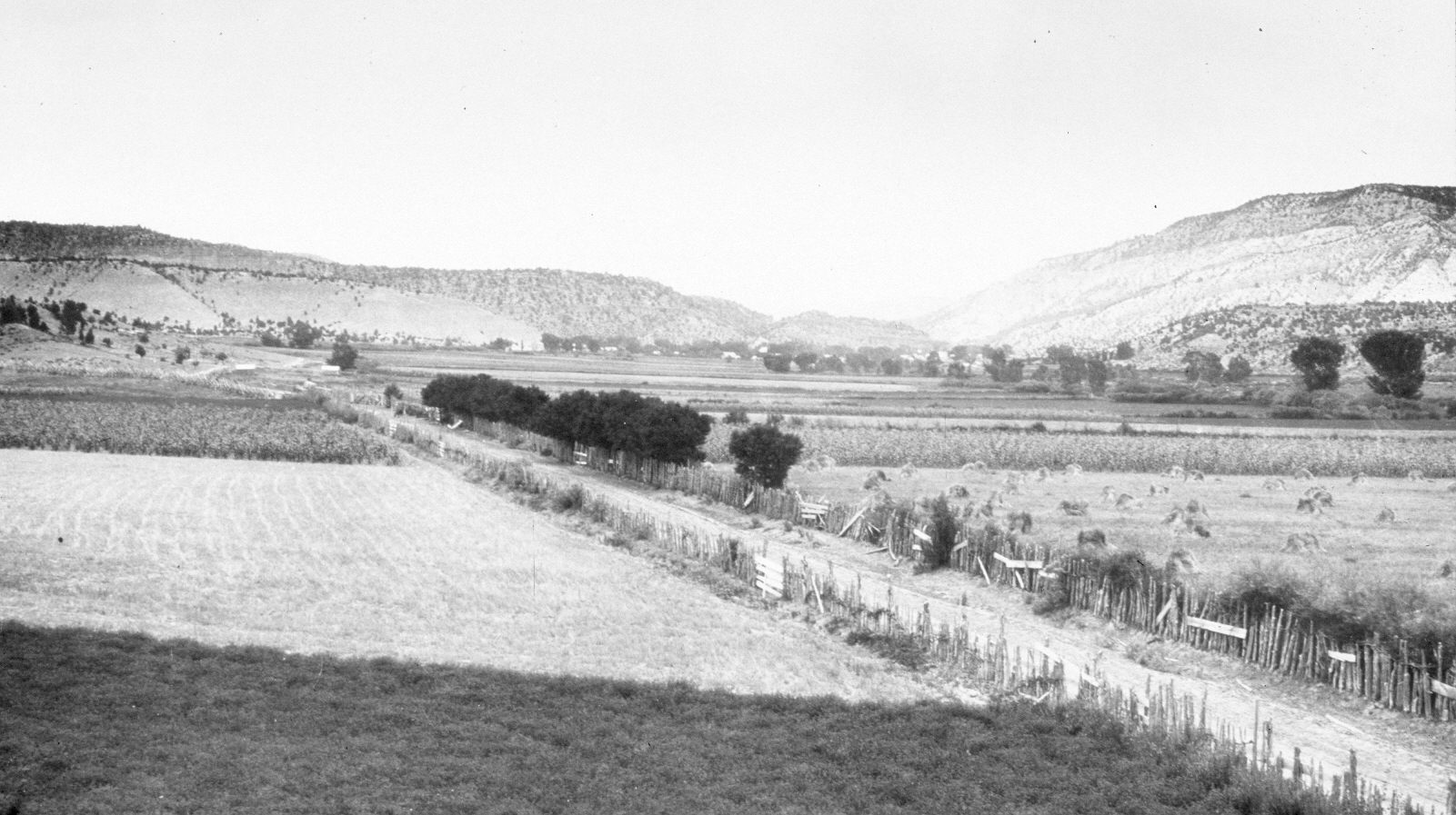
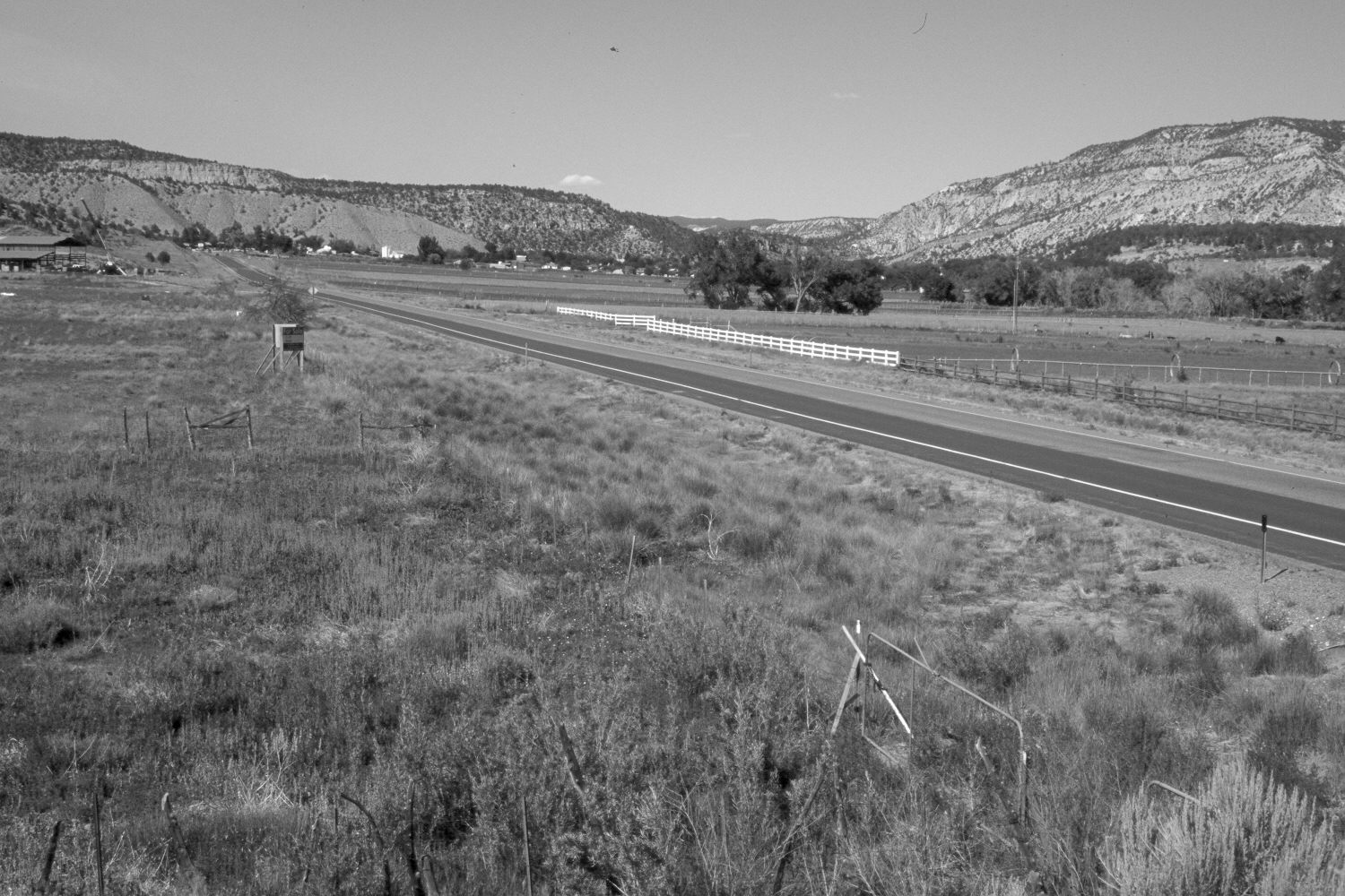
Orderville, Utah
1909
2004
Description:
Plate 550X. Orderville, UT 1909 – 2004 Viewed north-northwest to Orderville, UT. U.S. Highway 89 has been widened and paved. Cottonwoods and other woody riparian vegetation have increased along the East Fork of the Virgin River. Pinyon and junier have also increased.
Photo Information:
Original photograph taken by G.B. Richardson (No. 191) in 1909; retake by Charles E. Kay on July 2, 2004 - - Photo No. 5363-14. Original photograph held in the U.S. Geological Survey Photographic Library, Denver, CO.
Vegetative Community:
Riparian, Pinyon, Juniper
Location:
South West: Section 8, Range 7 West, Township 41 South; UTM 353200 E, 4124100 N; elevation 5,400 ft.
January 2018