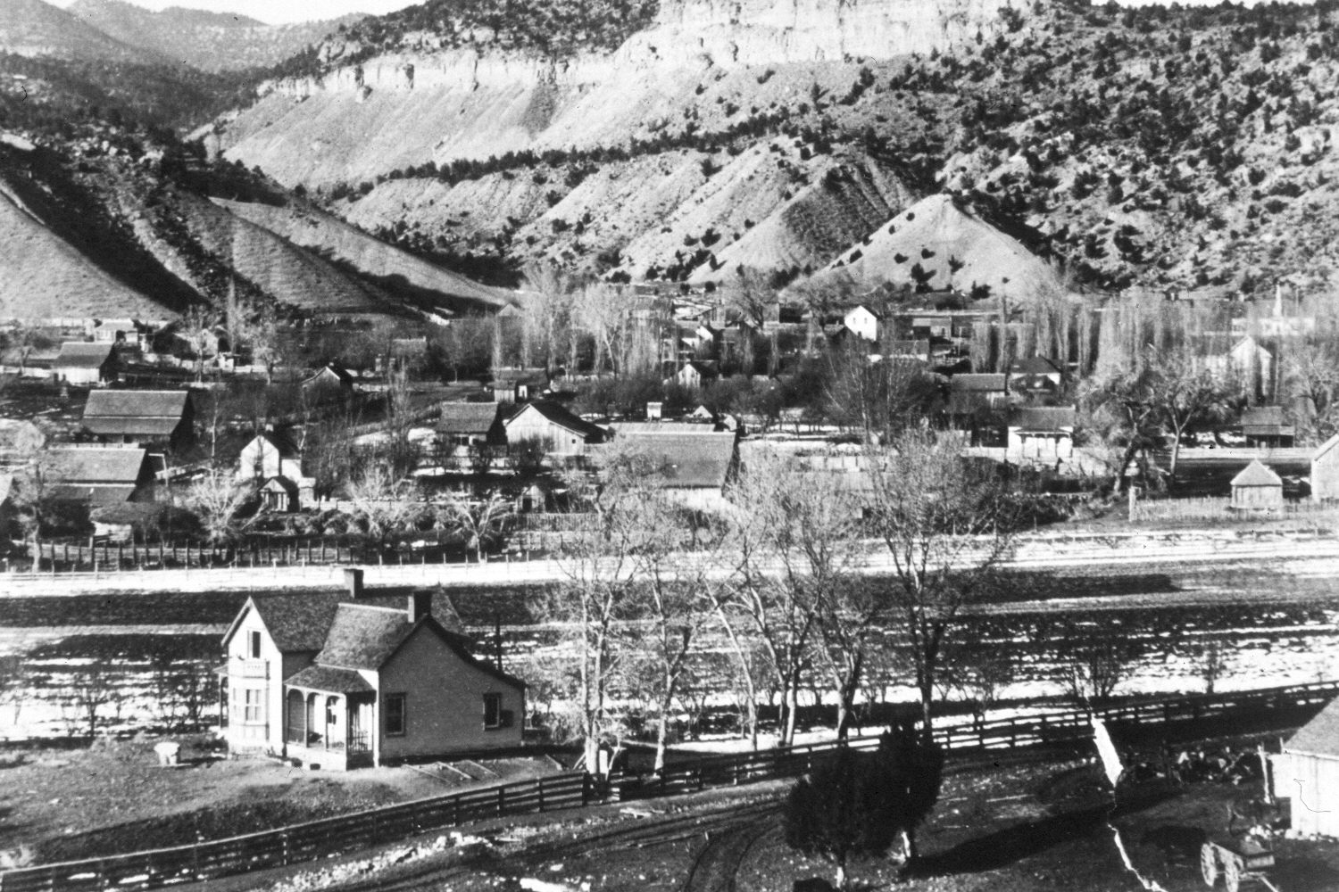
Orderville, Utah
1900
2004
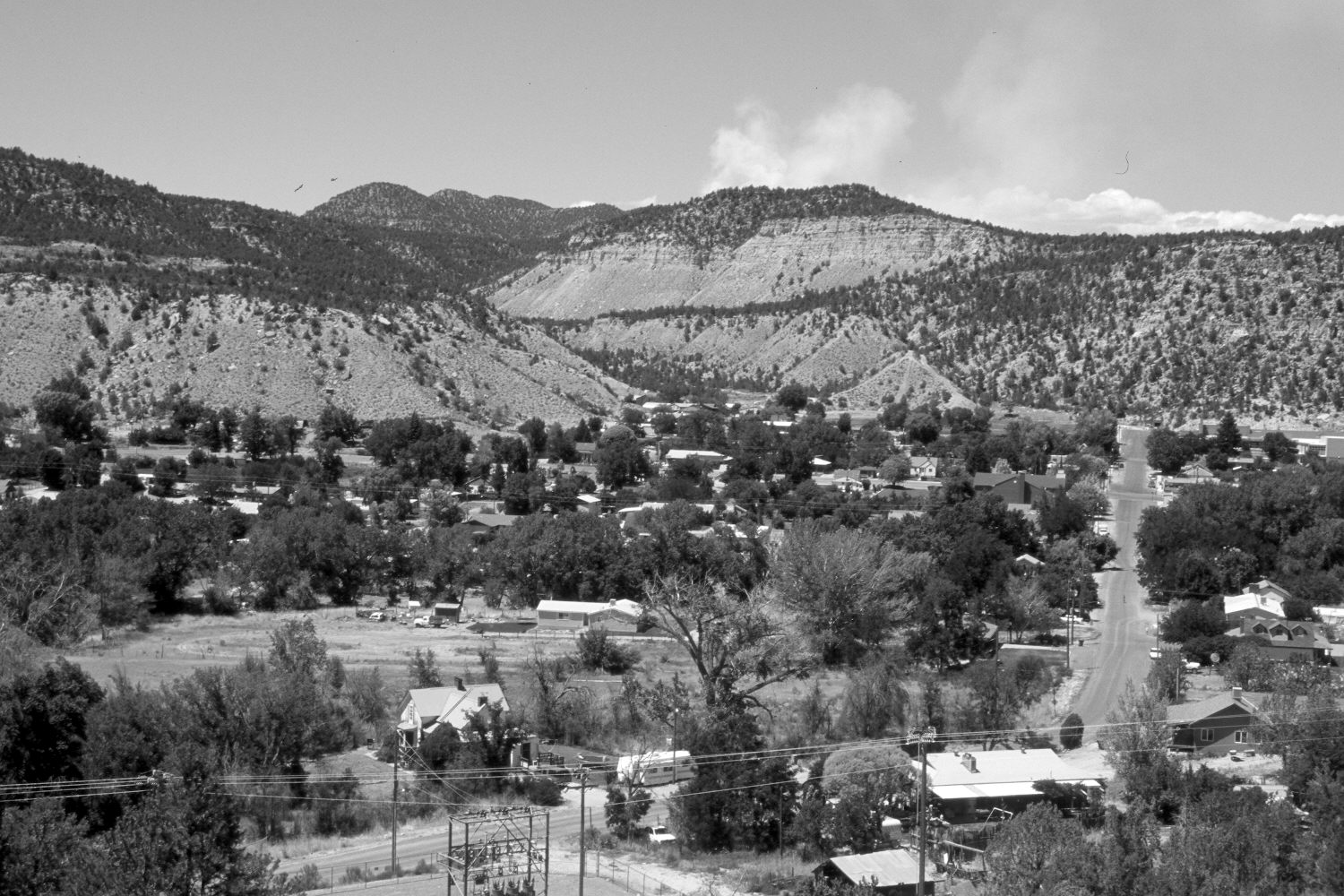
Description:
Plate 548X. Orderville, UT 1900- 2004 Viewed north-northwest to Orderville, UT. Pinyon and juniper now block the original photopoint, so the retake was made from the nearest open area, which is at a slightly higher elevation and a little further to the right. Cottonwoods have increased along the East Fork of the Virgin River. Pinyon and juniper have also increased. The smoke seen on the skyline in the retake is from a small wildfire that was quickly suppressed by federal agencies.
Photo Information:
Original photograph taken ca. 1900; retake by Charles E. Kay on July 2, 2004 - - Photo No. 5363-3. Original photograph (P-1093-12) held by the LDS Church Archives, Salt Lake City, UT.
Vegetative Community:
Riparian, Pinyon, Juniper
Location:
South West: Section 4, Range 7 West, Township 41 South; UTM 354750 E, 4125850 N; elevation 5,600 ft.