Orderville, Ut
1915
2005
Description:
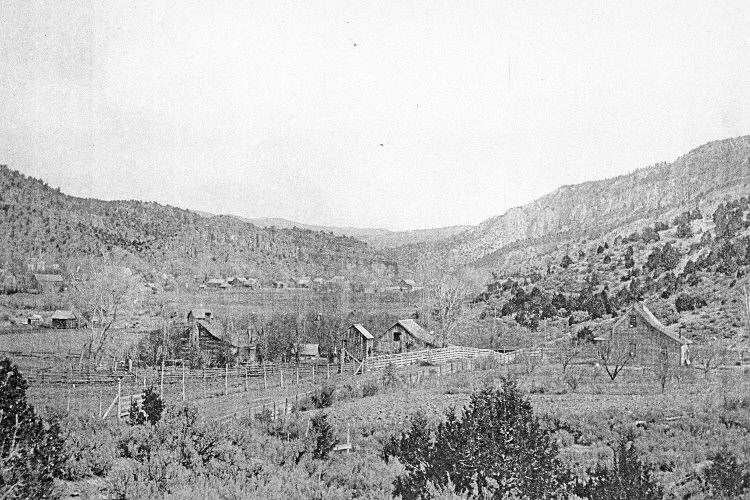
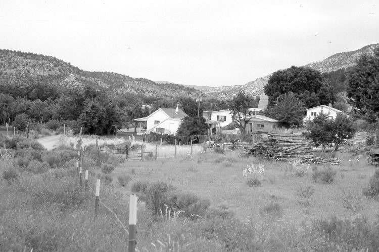
Plate 894X. Orderville, UT 1915 – 2005 Viewed northeast to Orderville, Utah. The original camera station has been consumed by a gravel pit, so the retake was made from the nearest open area. Woody riparian vegetation has increased along the East Fork of the Virgin River, while pinyon and juniper have increased on the slopes surrounding the town.
Photo Information:
Original photograph taken ca. 1915; retake by Charles E. Kay on June 21, 2005 - - Photo No. 5463-27. Original photograph held by the Kanab Museum, Kanab, UT.
Vegetative Community:
Riparian, Pinyon, Juniper
Location:
South West: Section 4, Range 7 West, Township 41 South; UTM 354200 E, 4125500 N; elevation 5,440 ft.
January 2018