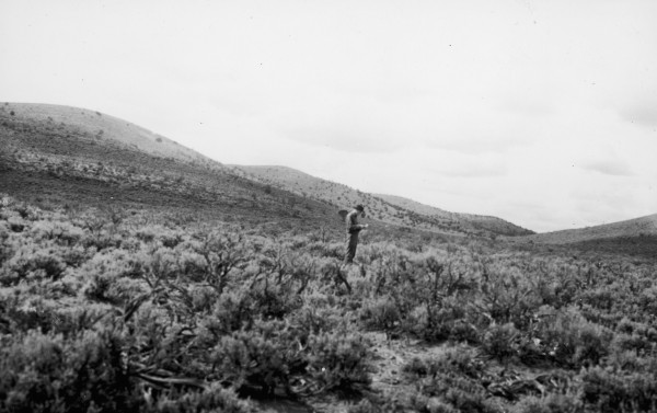
North Hills
1936
2007
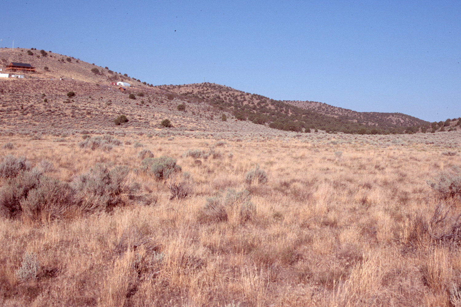
Description:
Plate 1484X. North Hills 1936 – 2007 Viewed west-southwest along the Iron County – Washington County line two miles north of Enterprise, Utah. The foreground has been root-plowed and reseeded with crested wheatgrass. Pinyon, juniper, and cliffrose have increased in the distance. The seeding has been invaded by cheatgrass and sagebrush. Homes have been built on the nearest hill (photo-left), as have radio towers on the next ridge to the west.
Photo Information:
Forest Service photograph (330772) taken on October 1, 1936; retake by Charles E. Kay on August 21, 2007 - - Photo No. 5830-2A. Original photograph held by the Utah Historical Society, Reed W. Bailey Collection (Box 15), Salt Lake City, UT.
Vegetative Community:
Dry Meadow, Pinyon, Juniper, Sagebrush
Location:
South West: Section 36, Range17 West, Township 36 South; UTM 260575 E, 4165592 N; elevation 5,315 ft.