North Fork Of Chalk Creek Pavant Mountains
1963
2000
Description:
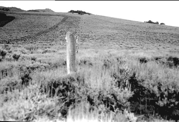
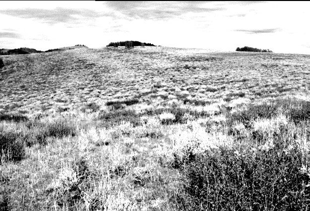
Plate 305. NORTH FORK OF CHALK CREEK PAVANT MOUNTAINS 1963-2000 Plates 304 and 305 form a panorama from northeast to east-northeast on the ridge between the North Fork of Chalk Creek (photo left) and Chokecherry Creek in the Pavant Mountains. This area was treated with a Dixie harrow and reseeded to eliminate sagebrush, but sagebrush has reinvaded the site. Snowberry is the darker-colored shrub. The fence has been removed. Aspen has not regenerated due to excessive browsing. Plate 305 is viewed east-northeast to Willow Creek Peak (9,765 ft).
Photo Information:
U.S. Forest Service photo (unnumbered) by B.G. Molyneaux on September 14, 1963; retake by Charles E. Kay on September 4, 2000 - - Photo No. 4719-24; Original photo (2200D) held by Fillmore Ranger District, Fishlake National Forest, Fillmore, UT.
Vegetative Community:
Sagebrush, Mountain Brush, Aspen
Location:
South Central: Section 36, Range 3 W, Township 21 S; UTM 400400 E, 4311100 N; elevation 9,440 ft.