Near Kane Springs
1905
1999
Description:
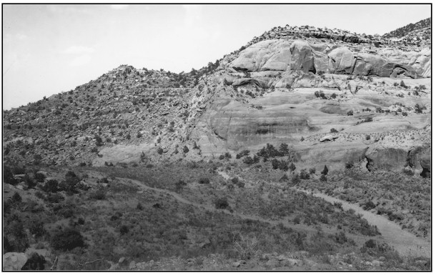
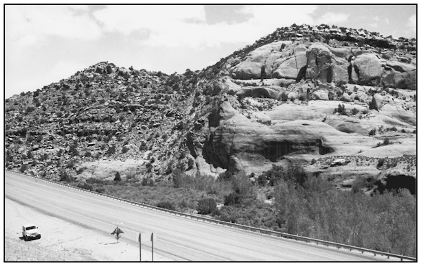
NEAR KANE SPRINGS The photopoint is on top of a highway 163 cut bank approximately 1/2 mile north of Kane Springs. The retake is 40 to 50 feet west of the original because the new road cut removed the original location. This northeast view is across public land administered by the Bureau of Land Management. In addition to the obvious channel alterations made by successive highway improvement projects, one can readily see the 15 to 20 year old cottonwood trees that have established along the segment of upper Kane Creek. The channel banks have begun to support a riparian habitat where none existed in Cross' 1905 photograph. The ephemeral nature of the stream at this point will somewhat limit further riparian habitat development.
Photo Information:
Photograph Number: Cross No. 796 Click here to view photograph Original: Date: 1905 (- A) Photographer: C.W. Cross Source: U.S. Geological Survey, Denver, Colorado Retake: Date: May 10, 1999 (- B) Photographer: Earl Hindley Source: San Juan County
Vegetative Community:
Riparian
Location:
San Juan: SW1/4NE1/4 Section 4 T.28S., R.22E.