Navajo Lake
1939
2004
Description:
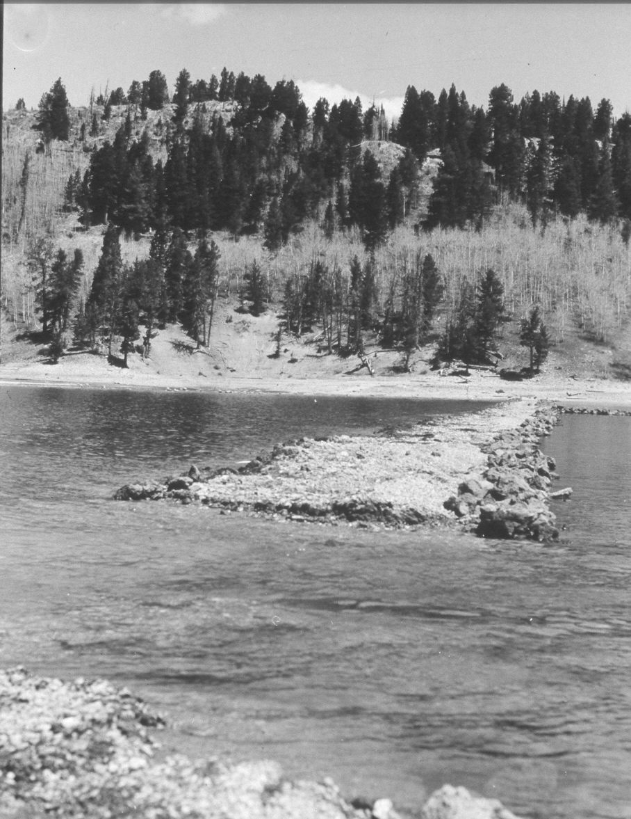
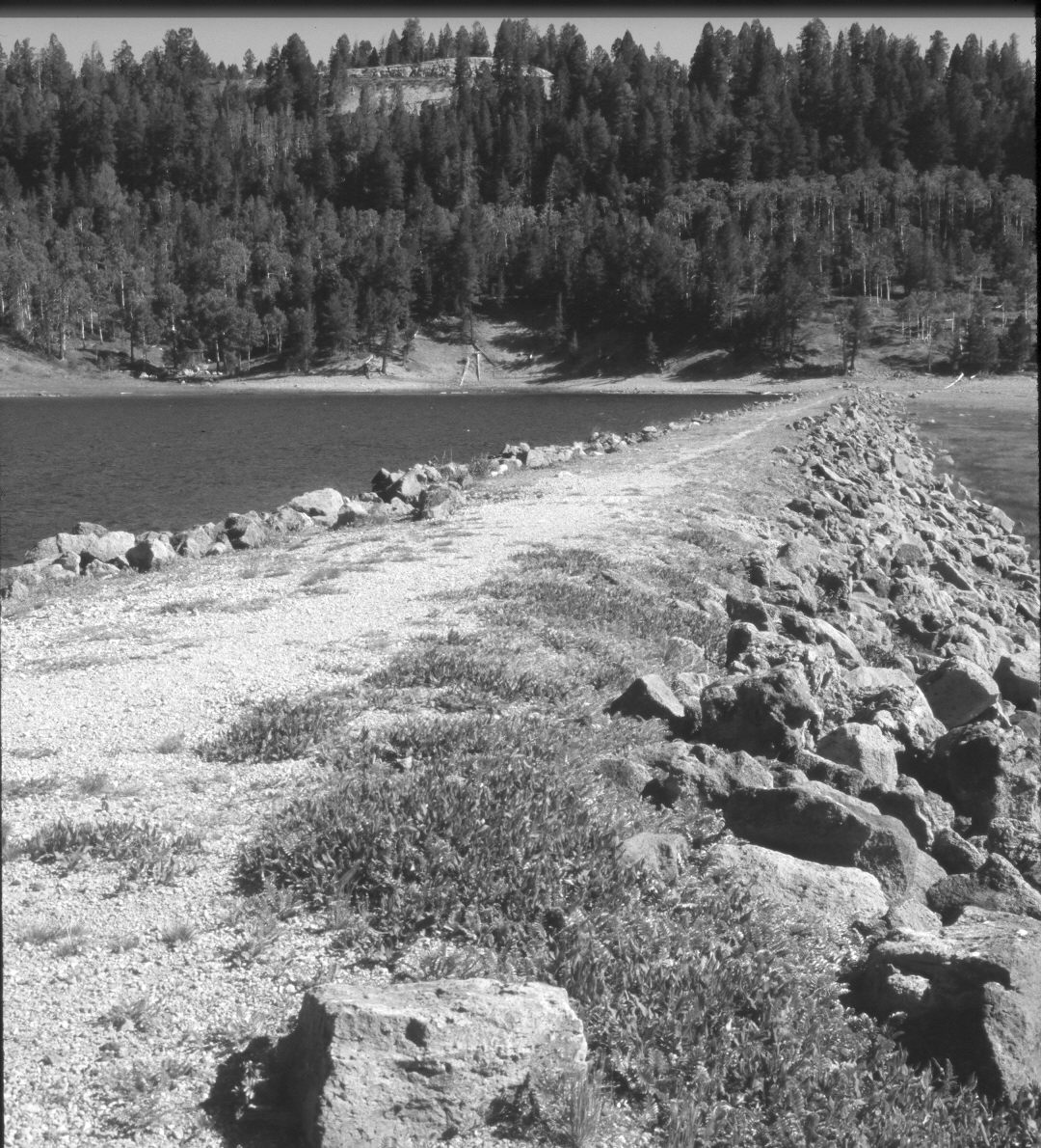
Plate 612X. Navajo Lake 1939 – 2004 Viewed north from the middle of the dam on Navajo Lake. As explained in earlier Plates, the dam was built to keep this natural lake from draining out its sink - - see Plate 608x. Shortly after the dam was built, however, the lake level rose during a wet spring and washed-out the dam. The dam was subsequently rebuilt to a higher standard. In the distance, conifers, primarily ponderosa pine and Douglas fir, have increased, while aspen has declined. The rock cut on top of the hill is the viewpoint on Utah Highway 14 - - see Plates 605x and 606x.
Photo Information:
U.S. Forest Service photograph taken in May 1939; retake by Charles E. Kay on August 10, 2004 - - Photo No. 5383-18A. Original photograph held by Southern Utah University Archives and Special Collections, Cedar City, UT.
Vegetative Community:
Riparian, Conifer, Aspen
Location:
South West: Section 8, Range 8 West, Township 38 South; UTM 344300 E, 4154000 N; elevation 9,030 ft.