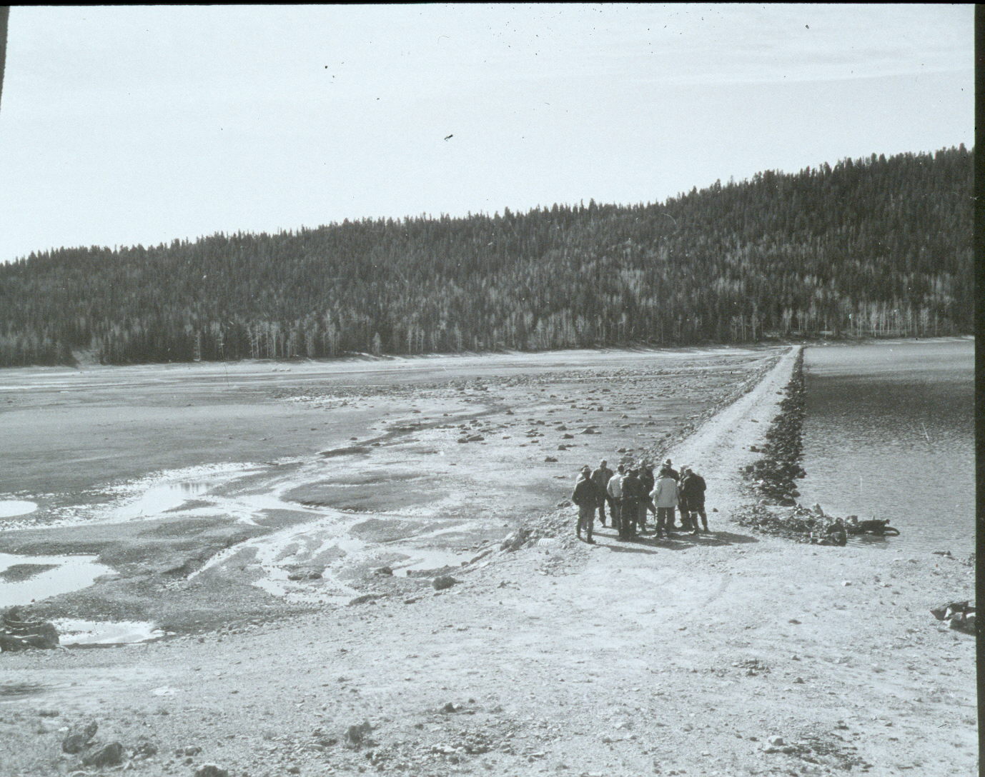
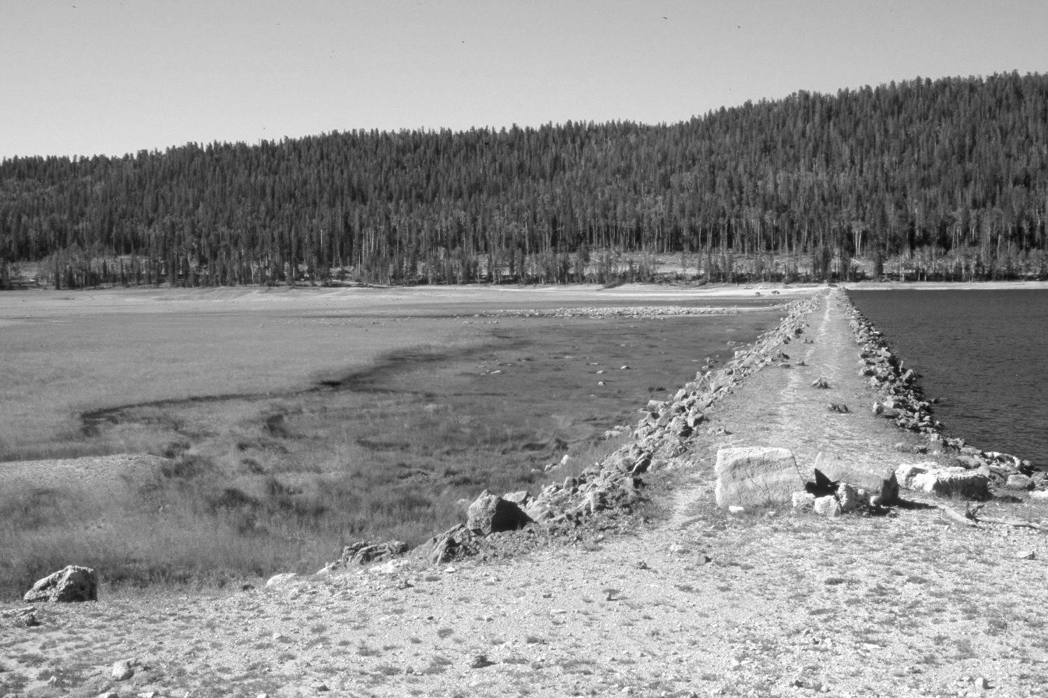
Navajo Lake
1939
2004
Description:
Plate 611X. Navajo Lake 1939 – 2004 Viewed southwest along the dam on Navajo Lake. The 1939 image shows the dam shortly after it failed and the spillway had washed-out - - see Plates 610x and 612x. In the distance, conifers have increased, while aspen has declined. Many spruce, however, have recently been killed by insects and disease. A new road right-of-way has been cleared on the far side of the lake.
Photo Information:
U.S. Forest Service photograph taken in May 1939; retake by Charles E. Kay on August 10, 2004 - - Photo No. 5383-16A. Original photograph held by Southern Utah University Archives and Special Collections, Cedar City, UT.
Vegetative Community:
Riparian, Conifer, Aspen
Location:
South West: Section 8, Range 8 West, Township 38 South; UTM 344400 E, 4154400 N; elevation 9,030 ft.